Loading...

Archive

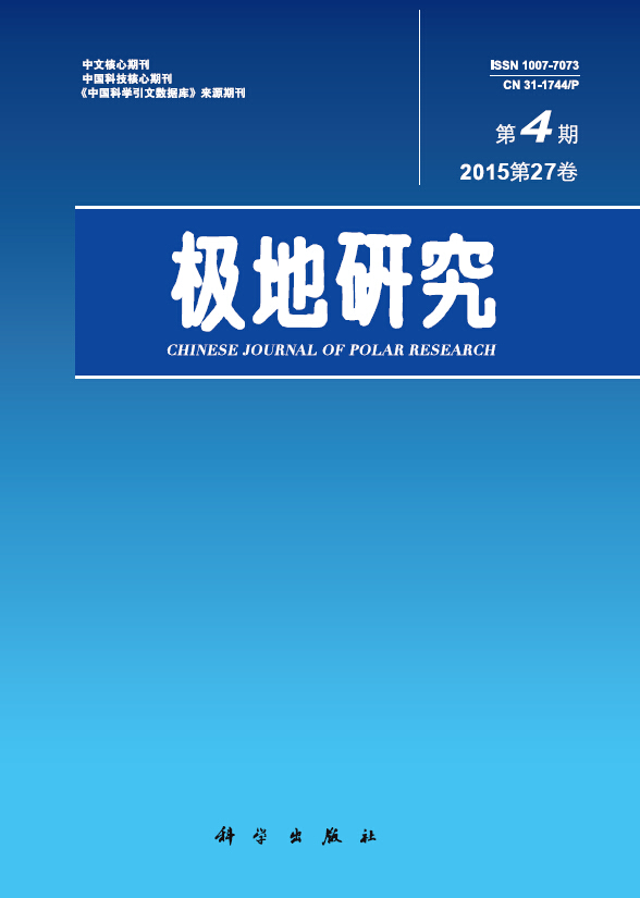
    30 December 2015, Volume 27 Issue 4 Previous Issue    Next Issue

    For Selected: Toggle Thumbnails
    SINK AND SOURCE CHARACTERISTICS OF SURFACE WATER SOUTH OF THE POLAR FRONT IN THE SOUTHERN OCEAN
    Zhan Liyang, Chen Liqi, ZHANG Jiexia, Li Yuhong, Wu Man, Xu Suqing
    2015, 27 (4):  337-343.  DOI: 10.13679/j.jdyj.2015.4.337
    Abstract ( 1050 )   PDF (1794KB) ( 854 )  
    N2O is one of the most important green house gases, which has been concerned for the past 5 decades. However, very limit studies reports the role polar oceans play in global N2O budget. Durint the 25th and 26th Chinese Antarctic Research Expedition, surface N2O sample were taken and analyzed. Result shows that N2O is oversaturated near the Subtropical Front, close to equilibrium near SubAntarctic Front and undersaturated south of the Polar Front (PF). The air-sea flux south of polar front is evaluated, result shows that region south of PF is sink of atmospheric N2O.
    Related Articles | Metrics
    METEOROLOGICAL CHARACTERISTICS OF INEXPRESSIBLE ISLAND, ANTARCTICA
    Ding Minghu, Bian Lingen, Zhang Lin, Wang Zhaomin, Lu Changgui, Sun Weijun, Yuan Naiming, Fu Liang, Xie Zelin
    2015, 27 (4):  344-350.  DOI: 10.13679/j.jdyj.2015.4.344
    Abstract ( 1087 )   PDF (4218KB) ( 909 )  
    In 2012/13 austral summer, the Chinese National Antarctica Research Expedition deployed an automatic weather station (AWS), to collect information regarding meteorological characteristics in Inexpressible Island for the candidate of new station. Parameters such as Air pressure, air temperature, relative humidity, wind speed and direction, solar radiation have been recorded for the past whole year. Based on these data and the historical data collected by United State and Italy, we evaluated the climate condition to provide basic environment for the other researches, which is also important for the safety of the future field explorers. The result shows that: (1) the annual mean air pressure in Inexpressible Island is 987.8 hPa, very close with in Zhongshan Station; (2) annual mean air temperature is -16.1 and the lowest air temperature is 39.3; (3) annual mean relative humidity is 42.1%, which implies low precipitation here; (4) the prevalent wind is coming from WNW and the wind speed is greater than 8 m s-1 during most of the year; however, the wind usually becomes weak during summer time and this is very beneficial for the supplement by Icebreakers; (5) the global radiation at Inexpressible Island (3342.8 MJ m-2) is obviously less than Zhongshan station, but there albedo is quite close with each other.
    Related Articles | Metrics
    ANALYSIS OF KATABATIC WIND ON THE COAST OF PRYDZ BAY
    Ding Zhuoming, Zhang Lin, Bian Lingen, Sun Qizhen
    2015, 27 (4):  351-363.  DOI: 10.13679/j.jdyj.2015.4.351
    Abstract ( 1132 )   PDF (10195KB) ( 719 )  
    Basing on the sounding observation of Ozone ballon and tower data (organized by Chinese Academy of Meteorological Sciences) and reanalysis data(ECWMF, ERA Interim), we analysed the synoptic weather patterns in the region of Prydz Bay and in the interior of Eastern Antarctica, characteristics of boundary layer in Zhongshan Station, the daily changes of meteorological elements. We also simulated the katabatic winds by logarithmic profile theory and tower data, and compared the results with observation. Case studies showed on sunny nights or cloudy daytime, the surface radiation cooling in the interior of Antarctica caused temperature reducing, and the the horizonal gradient of surface temperature from there to Prydz Bay was large. Air of inland was anticyclonic and divergent. The position of anticyclone determined intensify of the Katabatic wind in western and eastern Prydz Bay. When katabatic wind reached Zhongshan Station, it happened in the bottom of boundary layer. The wind direction was constant, mainly east and east northeast, leading to unstable stratification, making air temperature and potential temperature drop rapidly. The simulating capacity of logarithmic profile theory was limited.
    Related Articles | Metrics
    EFFECT OF NORTHERN HEMISPHERE MID-HIGH LATITUDE BLOCKING ON THE VARIATION OF SUMMER ARCTIC SEA ICE
    Xiao yiqing, Huang Bin, Diao Yina, Luo Dehai
    2015, 27 (4):  364-378.  DOI: 10.13679/j.jdyj.2015.4.364
    Abstract ( 1475 )   PDF (14442KB) ( 825 )  
    The relationship between mid-high latitude blocking in North hemisphere (NH) summer and the decline of summer Arctic sea ice is analyzed by using NCEP/NCAR daily 500 hPa geopotential height reanalysis data. Results show that there are high blocking frequencies over Bering Strait, Okhotsk Sea, Eurasia and Greenland, which are extremely similar to the areas with reduction of Arctic sea ice in the summer in recent 30 years, as observed from satellite data. The difference of surface temperature, meridional heat transport and temperature advection in 850 hPa anomaly fields between days with and without blocking are calculated to show that mid-high latitude blocking have a significant impact on the reduction of sea ice. The increase of blocking frequency in NH mid-high latitudes will increase the surface air temperature, poleward heat transport and temperature advection so as to accelerate the melting of Arctic sea ice. The thermodynamic effects caused by blocking over Okhostk Sea and Eurasia can significantly result in the reduction of Arctic the sea ice.
    Related Articles | Metrics
    VARIATIONS IN COASTAL POLYNYAS IN THE ALASKAN CHUKCHI SEA AND MAJOR INFLUENCE FACTORS
    LIANG Minyi, Shi Jiuxin
    2015, 27 (4):  379-391.  DOI: 10.13679/j.jdyj.2015.4.379
    Abstract ( 1152 )   PDF (8080KB) ( 805 )  
    Using daily AMSR-E sea ice concentration data from 2003 to 2011, the area of Alaska Coastal Polynyas in the Chukchi Sea was studied. According to the characteristics of these polynyas, threshold method was proposed to identify each polynya. Frequency of polynyas occurrence was also used to delimit the maximum range of polynyas in the studied region. Based on the information extracted from Alaska Coastal Polynyas, the temporal and spatial variations and their major influence factors were studied. To eliminate the effect of the open sea on the identification of polynyas, the analysis was limited between January and April when Bering Strait was totally covered by sea ice. The following conclusions were drawn: Every winter, five polynyas will appear along the Alaska Coastal area and are almost parallel to the coastline. In addition to the typical coastal polynyas, flaw polynyas tend to appear off landfast ice in the vicinity of Barrow Point in late March and April. Daily changes in polynya areas were dominated on synoptic scale, which is further related to the wind directions. Seaward winds favored the formation of coastal polynyas, but since northeast and north winds prevail in the studied region, polynya sites are sometimes closed or diminished in extent for up to a few weeks. Under the effect of northerly winds, Pacific Inflow has virtually no effect on the northern polynyas but has an important influence on the spatial distribution of southern polynyas along Alaska coastal area.
    Related Articles | Metrics
    PROGRESS IN THE STUDY OF 17O-EXCESS IN SNOW AND ICE OVER POLAR REGIONS
    He Jing, Pang Hongxi, Hou Shugui
    2015, 27 (4):  392-401.  DOI: 10.13679/j.jdyj.2015.4.392
    Abstract ( 1043 )   PDF (4057KB) ( 1005 )  
    17O-excess is a new frontier of water stable isotope studies , which has been drawn attention to over polar regions. This paper first systematically introduces the basic principle and experimental method of 17O-excess in the hydrological cycle. And then the latest research progresses of 17O-excess in snow/ice over polar regions, including the influence factors, spatial distribution, seasonal variations, and the last glacial-interglacial evolution of 17O-excess records in ice cores, are summarized. Finally, the future work on 17Oexcess is prospected based on the existing scientific issues in respect of 17O-excess.
    Related Articles | Metrics
    CHARACTERISTICS OF SURFACE MOVEMENT ON THE AUSTRE LOVÉNBREEN AND PEDERSENBREEN GLACIERS, SVALBARD, THE ARCTIC
    Li Peng, Yan Ming, Ai Songtao, Xu Yuetong, Liu Leibao, Sun Weijun
    2015, 27 (4):  402-411.  DOI: 10.13679/j.jdyj.2015.4.402
    Abstract ( 1012 )   PDF (3751KB) ( 1082 )  
    The glaciers Austre Lovénbreen and Pedersenbreen are located near Ny-?lesund, Svalbard, Arctic. The characteristics of surface movement are analyzed based on filed data from 2005 to 2011 on both glaciers. The results are as following: (1) The average horizontal velocities of Austre Lovénbreen and Pedersenbreen are 2.14 m?a-1 and 6.28 m?a-1 , respectively, and their corresponding variation coefficient are 0.24 and 0.14, respectively. The average horizontal velocity in summer of two glaciers is slightly higher than that in winter. There is a multinomial relationship between the glacial horizontal velocity and its elevation. The horizontal velocity is larger along glacial mainstream line than that on both sides, and its distribution is not symmetrical on both sides of Austre Lovénbreen glacier. Based on the glacial movement features, Austre Lovénbreen can be divided into three regions from its origin to terminal, and they are compressional region, stretching region and compressional region in order. (2)The average vertical velocities of Austre Lovénbreen and Pedersenbreen are 0.76 m?a-1 and 0.90 m?a-1 respectively, and their corresponding variation coefficient are 0.81 and 0.59, respectively. The vertical velocities are bigger in summer with a smaller variation coefficient than that in winter .There is a linear relationship between the glacial vertical velocity and its elevation. According to their contribution to the composition of vertical velocity on Austre Lovénbreen, height changes caused by surface mass balance makes the greatest part in 64%, followed by compensation flow (19%) and horizontal velocity components (16%). On Pedersenbreen, in contrast, height change caused by surface mass balance makes the greatest contribution in 40%,followed by horizontal velocity components (35%) and compensation flow (25%). (3) The surface strain rate decreases firstly and then increases along the mainstream line direction on Austre Lovénbreen and Pedersenbreen, and their corresponding average variation coefficient are 0.19 and 0.15, respectively.
    Related Articles | Metrics
    SPECIATION OF PHOSPHORUS IN SURFACE SEDIMENTS OF THE PRYDZ BAY, ANTARCTICA
    He Lelong, Yu Peisong, Zhang Haifeng, Han Zhengbing, Cai Xiaoxia, Pan Jianming, Zhang Haisheng
    2015, 27 (4):  412-420.  DOI: 10.13679/j.jdyj.2015.4.412
    Abstract ( 984 )   PDF (4361KB) ( 1003 )  
    Speciation of phosphorus in surface sediments which were collected during several CHINARE cruises in Prydz Bay were investigated. The sequential extraction method(SEDEX) was used to separate and quantify the following five sedimentary P reservoirs: exchangeable phosphorus (ExP), iron phosphorus (FeP), authigenic phosphorus (AuP), detritus phosphorus (DeP) and organic phosphorus (OP). DeP and AuP were the major types of phosphorus in surface sediments, with an average of 37.5% and 25.8% to total P. The obvious positive relationships between OP, AuP and OC, Sibio indicated that they might come from the same source which was mainly from marine biogenic matters. DeP could be observed positively correlated with Al and sandy sediments, which preferences land sources that might be carried by sea ice with current. It was shown that the content and distributions of P in sediments were majorly controlled by the sources of P, also included the grain size of sediments and other physical factors such as sea ice and current.ExP was controlled by grain size of sediments, while FeP was controlled by iron. In addition, either ExP or FeP was a small components in total phosphorus, only 8.9% and 6.5% respectively. Bioavailable phosphorus concentrated in the central and eastern region, with an average content of 37.2% to total P.
    Related Articles | Metrics
    CHARACTERISTICS OF GRAIN SIZE IN SURFACE SEDIMENTS FROM THE CONTINENTAL SHELF, PRYDZ BAY, AND IMPLICATIONS FOR SEDIMENTARY ENVIRONMENT
    Wang Haozhuang, Chen Zhihua, Wang Chunjuan, Liu Helin, Zhao Renjie, Tang Zheng, Huang Yuanhui
    2015, 27 (4):  421-428.  DOI: 10.13679/j.jdyj.2015.4.421
    Abstract ( 1152 )   PDF (3884KB) ( 1092 )  
    Through analyzing the grain size characteristic of continental shelf surface sediments obtained during Chinese 24th and 29th South Pole Exploration in Prydz Bay,Southern Ocean to discuss the main factors influence sedimentation. The surface sediments are divided into nine types: G, msG, gM, gmS, (g)M, (g)mS, S, sZ, Z. The study area can be divided into two sections by sediment types and topography of the bay: gravelly mud section in east and gravelly sand section in west. In the eastern gravelly mud section, coastal current dominates sedimentation processes in Four Ladies Bank and Svenner Channel. In Prydz Channel and Amery Basin, Prydz Bay Gyre is the dominant factor controlling sedimentary processes. In contrast, icebergs are the primary factors influence sedimentation in front of Amery Ice Shelf and Fram Bank, while the influencing of current is weak.
    Related Articles | Metrics
    THE IMPACT OF USING THE ARCTIC ROUTE ON TRADE IN CHINA AND ITS ACCESSIBLE AREAS
    Li Zhen,Hu Maixiu
    2015, 27 (4):  429-438.  DOI: 10.13679/j.jdyj.2015.4.429
    Abstract ( 1167 )   PDF (2331KB) ( 1047 )  
    Considering waiting time and sea ice, this article employs a modified gravity model by substituting sailing time for shipping distance, quantitatively evaluating influence on trade potential of China and its affected area by using the Arctic navigation. Results show that: (1) There is a negative correlation between sailing time and total value of import and export. If sailing time is reduced by 1%, total volume of import and export of China will be increased by 0.6590%. (2) The presence of sea ice has a great impact on trade potential. At present with sea ice, trade potential of China can be enhanced by 10.95% averagely, and that of its affected area can be increased by 12.02% for northern coastal area and 11.22% for eastern coastal area, due to the natural advantage in shipping distance of the "Arctic Passage ". But once sea ice melts and the "Arctic Passage" is in full navigation, trade potential of China and its affected area will be further increased, and the promotion effect will reach more than 20%.
    Related Articles | Metrics
    ANALYSIS OF POLAR SCIENCE RESEARCH SUPPORTED BY THE NATIONAL NATURAL SCIENCE FOUNDATION OF CHINA FROM 1998 TO 2014
    Zhu Chunyan, Hua Weina
    2015, 27 (4):  439-445.  DOI: 10.13679/j.jdyj.2015.4.439
    Abstract ( 916 )   PDF (1602KB) ( 889 )  
    An analysis is conducted based on collection of polar science projects supported by National Natural Science Foundation of China from 1998 to 2014, then discusses the number of projects in every year, the types of projects, discipline and diversity variation, affiliations and so on, combined with papers on polar science including domestic and oversea. On the basis of the analysis, the study concludes that the fund promotes the development of human resource and the ability of scientific research on polar sicence, at the same time it is very important to pay attention to increase funding and grantees, energizing the international cooperation and exchange.
    Related Articles | Metrics
    CRYOSAT-2 SATELLITE ALTIMETRY AND ITS APPLICATION
    Wei Xin, Li Fei, Zhang Shengkai, Hao Weifeng
    2015, 27 (4):  446-453.  DOI: 10.13679/j.jdyj.2015.4.446
    Abstract ( 1399 )   PDF (1582KB) ( 1211 )  
    Equipped with a Ku-band SIRAL(SAR/Interferometric Radar Altimter), CryoSat-2 has been launched in 2010 as the first European Space Agency Earth Explorer Opportunity mission.CryoSat-2 has the advantage of measuring fluctuations in Earth’s land and marine ice fields with high precision.The low earth, polar orbit at inclination of 92? fills the previous remote sensing satellite data gaps in a certain extent. In this paper, an overview is provided of the CryoSat-2’s scientific objectives, scientific requirement, mission, instrument concept and data products, with an emphasis on the primary load SIRAL and data calibration. Finally the applications of CryoSat-2 in polar region are introduced.
    Related Articles | Metrics
    RESEARCH PROGRESS ON THE IMPACT OF CLIMATIC CHANGE ON ARCTIC FISHERY RESOURCES
    Jiao Min, Chen Xinjun, Gao Guoping
    2015, 27 (4):  454-462.  DOI: 10.13679/j.jdyj.2015.4.454
    Abstract ( 1084 )   PDF (1666KB) ( 1161 )  
    Abstract: In last several decades, climate changes are increasingly serious, which has great influence on the fishery resources in the Arctic. The changes including seawater warming, sea level rise and sea ice reduction are caused by climatic variation. All these changes not only directly affect the arctic fishery breeding, life history and temporal-spatial distribution, but also indirectly affect arctic fishery by the ocean current, the Arctic oscillation and ozone sphere. The impact of climate change on the structure and quantity of the Arctic fisheries is irreversible and its impacts are also wide in every aspect. In this paper, we find out the main factors affecting the Arctic fishery resources by analyzing major climate variation. The results will provide the basis for protecting the Arctic fishery resources and also make the development of Arctic fishery more healthy and sustainable.
    Related Articles | Metrics