Loading...

Archive

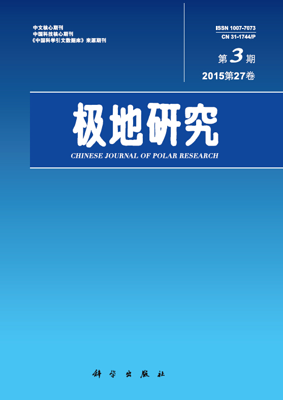
    30 September 2015, Volume 27 Issue 3 Previous Issue    Next Issue

    For Selected: Toggle Thumbnails
    APPLICABILITY PISM FOR VELOCITY ANALYSIS OF THE AMERY ICE SHELF, EAST ANTARCTICA
    Ji Qingyuan, Wang Bangbing, Sun Bo
    2015, 27 (3):  229-236.  DOI: 10.13679/j.jdyj.2015.3.229
    Abstract ( 1077 )   PDF (2263KB) ( 1021 )  
    In the context of global climate change, ice shelf systems have become critically important for accessing ice sheet stability. Conventionally, measurement-based approaches are limited in addressing ice sheet motion and evolution. Ice sheet modeling provides a valuable and effective tool to study the dynamics and evolution of ice shelves. The Lambert-Amery ice shelf system, the largest glacier system in East Antarctica, and a vital part in researching the mass balance and stability of East Antarctica Ice Sheet, is studied with the PISM ice sheet model. We simulate the surface ice velocity field of this glacier system and compare the model result with actual measurement by remote sensing. The comparison indicates that the model performs well in predicting the velocity field across the Amery Ice Shelf. We further discuss the prospect of applying ice sheet model in research on the evolution of ice sheets and ice caps.
    Related Articles | Metrics
    BIOGENIC SILICA CONTENT AND MORPHOLOGY OF SOIL AT Ny-ALESUND, THE ARCTIC
    Liu Sen, Ran Xiangbin, Zang Jiaye, Wang Nengfei
    2015, 27 (3):  237-245.  DOI: 10.13679/j.jdyj.2015.3.237
    Abstract ( 907 )   PDF (2571KB) ( 904 )  
    Global silicon cycle is closely related to carbon cycle. Biogenic silica (BSi) is an essential part in the global silicon cycle as an important carrier of silicon. Lots of studies on the silicon cycle of terrestrial ecosystems have been reported, but researches on silicon in poplar regions are extremely rare. Using the soil and plant samples obtained from the fifth Chinese Arctic Scientific Expedition, BSi content and phytolith morphology were analyzed in the soil near Chinese Yellow Station in the Ny-?lesund, Arctic. The main conclusions are as follows: In the topsoil of Svalbard, the content of particle organic carbon (POC) and particle organic nitrogen (PON) ranges from 1.00 to 69.3 mg?g-1 and 0.11 to 9.84 mg?g-1, with an average of 13.7 mg?g-1 and 1.43 mg?g-1, respectively. The concentration of soluble silica is from 3.90 to 26.3 μg?g-1, with an average of 10.7 μg?g-1 in soil. And BSi is between 5.60 and 9.97 mg?g-1, with an average of 7.56 mg?g-1 in soils of this study area. It shows a positive correlation between BSi and PON and POC, indicating that their sources were same to some extent in soil. And BSi content is higher in the topsoil of Arctic than that in temperate and tropical regions. Phytoliths in the plants are observed in forms of cap-shaped, round, smooth rod, tooth-shaped, spiny bar and dumbbell-shaped, etc, with a size between 10 and100 μm. Phytolith and diatom are both found in soil samples as compositions of BSi. Phytolith is the dormant BSi in the soil with vegetation covered. While Diatoms (Pennatae) are mostly found in the bare soils, which account for ~93.3% of the BSi. Phytolith in soil samples are mainly from plants inferred from the similarity of the morphology to phytolith in plants. The contents of POC, PON, soluble silica, BSi and the abundance of phytolith are higher in soil samples with vegetation covered than in the bare soil, suggesting that the silicon cycle in soil are significantly affected by plants in Arctic area.
    Related Articles | Metrics
    BACTERIAL COMMUNITY COMPOSITION AND ABUNDANCE OF PLANKTONIC BACTERIA IN ARCTIC KONGSFJORDEN IN THE SUMMER OF 2011
    Qiao Zongyun, Zeng Yinxin, Dong Peiyan, Zheng Tianling
    2015, 27 (3):  246-254. 
    Abstract ( 876 )   PDF (2590KB) ( 1143 )  
    Bacteria are one of major components of the marine food web and play an important role in marine ecosystems. High abundance of bacteria has been reported in the Arctic Kongsfjorden. Being a typical Arctic fjord, the Kongsfjorden is part of the north-western coast of Svalbard. Freshwater input from glaciers inevitably affects the bacterial communities in Kongsfjorden during summer season. Community fingerprint analysis of surface water and sediment samples collected in the summer of 2011 was performed by using a polymerase chain reaction-denaturing gradient gel electrophoresis (PCR-DGGE) approach. Sediment bacterial communities were found to show higher diversity index than surface seawater. Due to the influence of terrestrial freshwater input, sediments from station with water deeper than 200 m showed different bacterial communities from surface seawaters, as well as the sediment from station with water shallower than 40 m. Differences in bacterioplankton community compositions were also observed between the inner and outer part of the fjord. Sequences of DGGE bands fell into six major lineages of the domain Bacteria, includingα-,γ- andδ-Proteobacteria, Bacteroidetes, Actinobacteria, and Firmicutes. In contrast to similar abundance of planktonic bacteria between the outer and inner part of Kongsfjorden on the basis of quantitative PCR (QPCR) assay, higher abundance of Roseobacter clade was detected in the outer part than inner part of the fjord. Results in this study suggest that, compared to outer part, inner part of Kongsfjorden were more affected by terrestrial freshwater input, resulting in differences in bacterial community composition as well as abundance of specific bacterial species. In addition, compared to investigation in the summer of 2007, lower diversity of planktonic bacteria was found in this study. Whether those differences reflect the response of bacterial communities in Kongsfjorden to global climate change remains uncertain.
    Related Articles | Metrics
    AURORAL EVENT CLASSIFICATION USING ORIENTED ENERGY-BASED REPRESENTATION
    Zhang Jun, Hu Zejun, Wang Qian, Liang Jimin
    2015, 27 (3):  255-263.  DOI: 10.13679/j.jdyj.2015.3.255
    Abstract ( 1152 )   PDF (3216KB) ( 949 )  
    The auroral event is a physical phenomenon with rich information of texture, morphology and motion. Therefore, there is an urgent need to have a representation which captures these information simultaneously. Addressing to this problem, a three dimensional dynamic texture representation method based on oriented energy with binary coding is proposed for auroral event representation and automatic classification. At first, the local texture and oriented motion are described by the decomposition of energy into different orientations. Secondly, combining with the block partition strategy, the global morphology information is obtained as well. In order to obtain the statistical histogram, the technique of binary coding is applied for the fusion of energies with different orientations. Finally, the classifiers of nearest neighbor and support vector machines are used for classifying the auroral events from Chinese Arctic Yellow River Station. The classification results demonstrate that the proposed method achieves superior classification performance using nearest neighbor classifier compared with other two representative dynamic texture representation methods. The proposed method is specifically designed for auroral event representation, which is independent to the duration and captures the local texture, global morphology and motion simultaneously. It provides a feasible method for automatic classification of massive auroral events.
    Related Articles | Metrics
    PRECIPITABLE WATER VAPOR AT ARCTIC YELLOW RIVER STATION MEASURED USING GPS TECHNOLOGY
    Zhang Shengkai, Zhao Yun, E Dongchen, Ning Xinguo, Xu Youwei, Lei Jintao
    2015, 27 (3):  264-270.  DOI: 10.13679/j.jdyj.2015.3.264
    Abstract ( 913 )   PDF (1765KB) ( 993 )  
    This paper mainly discusses the method of calculating Precipitable Water Vapor at Arctic Yellow River Station by using ground-based GPS technique. Three factors Zenith Total Delay, Zenith Hydrostatic Delay and weighed mean temperature which effect PWV are analyzed, the reliability of Zenith Total Delay and Zenith Hydrostatic Delay is proved, we also get the model of weighed mean temperature fits for Yellow River Station region located in Arctic. With the comparison of GPS Precipitable Water Vapor and the result of radiosonde, the root mean square is less than 2 mm.
    Related Articles | Metrics
    A NEW APPROACH USING REMOTE SENSING TECHNOLOGY TO ESTIMATE REGIONAL-SCALE AIR-SEA CO2 FLUX
    Xu Suqing, Chen Liqi
    2015, 27 (3):  271-281.  DOI: 10.13679/j.jdyj.2015.3.271
    Abstract ( 1027 )   PDF (996KB) ( 1252 )  
    The estimation of air-sea carbon flux is the important part of global carbon cycle research. With the development of remote sensing technology and the progress in extrapolation method, a new approach applying remote sensing technology to estimate regional-scale air-sea CO2 flux based on the analyses of sea surface pCO2 and its dominant controlling factors. A regional-scale temporal and spatial distribution of sea surface pCO2 and long time series patterns of carbon sink or source can be obtained by the new approach. In this study, we represent the development of the extrapolation method by single regression, double regressions and multiple regressions and the successful application in the open ocean and the coastal region. We also summary the application in the Southern Ocean and in the Arctic ocean and the implication in the future.
    Related Articles | Metrics
    SPATIO-TEMPORAL VARIATIONS OF SEA ICE AND NAVIGABILITY IN THE ARCTIC VILKITSKY STRAIT
    2015, 27 (3):  282-288.  DOI: 10.13679/j.jdyj.2015.3.282
    Abstract ( 1474 )   PDF (3810KB) ( 1153 )  
    Abstract Vilkitsky Strait is an important and critical region in the Northeast Passage in Arctic.Spatio-temporal patterns of sea ice and navigability in Vilkitsky Strait were analyzed using sea ice concentration data spanning from 2002 to 2013. The results indicated that in Vilkitsky Strait sea ice condition is suitable for shipping during the period from late-August to mid-October. Large inter-annual variability of sea ice has possessed significant influence on shipping time. The time-period suitable for shipping in the strait is more than 40 days from 2002 to 2013. But the start time for shipping often fluctuates from July to September, and the end time for shipping is relatively concentrated in October.
    Related Articles | Metrics
    EVOLUTION OF THE FLYING GEESE MODEL FOR BOHAI SEAPORTS WITH OPENING OF THE NORTHEAST PASSAGE
    Li He, Li Zhenfu
    2015, 27 (3):  289-297.  DOI: 10.13679/j.jdyj.2015.3.289
    Abstract ( 958 )   PDF (1296KB) ( 1002 )  
    As an important part of Arctic routes, compared with Northwest Passage, Northeast Passage has a greater value to our country, and it has huge impact on economic development, marine trade, and port scale etc. Therefore, based on summing the close contact of shipping routes and port scale, the paper refers Bohai sea ports as the research object, and mainly analyses the impact Northeast Passage has on the cargo throughput, container throughput and operational efficiency for Bohai ports. Then the paper deeply analyses the comprehensive scores before and after the opening of Northeast Passage with principal component analysis, indicating that the opening will not break the current stage of Flying Geese Model of Bohai sea ports, but the development order for different ports will change in the same level. So, in response to this situation, the paper puts forward different development proposals to these ports.
    Related Articles | Metrics
    MEASURES AND RESULTS OF RUSSIA'S ARCTIC STRATEGY IN RECENT YEARS: A PERSPECTIVE OF GEOPOLITICS
    Lu Junyuan
    2015, 27 (3):  298-306.  DOI: 10.13679/j.jdyj.2015.3.298
    Abstract ( 1367 )   PDF (1400KB) ( 1334 )  
    Considering of Russia’s geopolitical interests in the Arctic, the Russian federal government is making great efforts to implement its Arctic strategy. Russia has taken various measures in the process and gained some effects. The main measures and effects include: strengthening strategic control of the Arctic region and gradually establishing domination of the multi-level geopolitical space in the Arctic; actively driving the construction in Russia’s Arctic as a "resource strategic base", promoting economic and social development of the region, enhancing Russia’s strategic position in the energy pattern of the word; controlling the "Northern Sea Route" as a pivot of transportation, trying to gain the geostrategic dominance and the initiative of international relations; actively expanding Russia’s space of national interests to the high Arctic Ocean through the works in the fields of science, law and others.
    Related Articles | Metrics
    DESIGN AND IMPLEMENTATION OF ANTARCTIC POSITIONING SOFTWARE BASED ON ANDROID
    2015, 27 (3):  307-311.  DOI: 10.13679/j.jdyj.2015.3.307
    Abstract ( 960 )   PDF (2247KB) ( 787 )  
    In order to satisfy the needs of real-time positioning for Antarctic personnel, the Antarctic personnel positioning software is designed and implemented. The software is based on the Android smart phone platform, used ArcGIS API for Android, according to the Antarctic geographical environment, combined with ArcGIS Server platform and GPS positioning technology. The software has functions for map browsing, positioning, electronic compass, navigation, recording and calculating distance. The software design and development processes is presented in a gradual fashion, with emphasis on the design plan of the map , the main functions of the software and the analysis of results. The mobile phone software is practical for the premise, use the technology of map cache on ArcGIS Server, so that Antarctic real-time offline positioning function which is based on the GIS map service become a reality. The mobile phone software interface is friendly and easy to operate. Testing at the ZhongShan station in South Pole, it proved that the software is runs normally and realize the function of the design objectives and precise positioning .The software provides the convenience of mobile location services for the Antarctic scientific research personnel.
    Related Articles | Metrics
    DESIGN AND IMPLEMENTATION OF XUELONG MONITORING SYSTEM BASED ON IOS PLATFORM
    2015, 27 (3):  312-318.  DOI: 10.13679/j.jdyj.2015.3.312
    Abstract ( 1051 )   PDF (2934KB) ( 1096 )  
    "Xuelong" is the most advanced scientific research vessel in China. With the continuous development and improvement of Xuelong online information platform, the demand for access to the latest "Xuelong" information via mobile terminals becomes more urgent. In order to build a information iOS platform which links "Xuelong" with the public and staff, we design and develop the Xuelong monitoring system based on iOS platform. The system is a C/S structure of the online App system, aims to achieve a real-time display "Xuelong" track, query the historical track, display relevant elements of data, receive and publish information, query the key node information and so on. It solves the screening of the key turning point among the massive route nodes, and the problem of straight line can’t across the 180 degree line of longitude while drawing route and other issues. Successfully applied to help relevant staff know the latest information of "Xuelong" and make right decisions without delay.
    Related Articles | Metrics
    RESEARCHES OF THE SECONDARY METABOLITES OF TWO ARCTIC-DERIVED FUNGUS
    Yan Ningxing, Fang Shasha, Liu Jingtang, Lu Xiaoling, Liu Xiaoyu, Jiao Binghua
    2015, 27 (3):  319-325.  DOI: 10.13679/j.jdyj.2015.3.319
    Abstract ( 1100 )   PDF (1214KB) ( 1001 )  
    Nine compounds were obtained from the fermentation broth of the Arctic-derived fungus Articulospora sp. Z1-1 and Penicillium sp. S-1-10. The broth extract was isolated and purified by column chromatography on silica -gel, Sephadex LH-20 and HPLC. The structures were elucidated by physical and chemical properties and spectral analysis, and comparison with the data of literatures. The nine compounds were identified as 3,7-dihydroxy-9 -methoxy-1-methyl-benzo[c]chromen-6-one (1), 1,4-dihydroxytoluene (2), 3-hydroylmethy phenol(3), 2-hydroxyphenethyl alcohol (4), dibutyl phthalate (5), 1,7-dihydroxy-3-hydroxyl-8methyl-dibenzo[b, e] oxepine-13, 14-dion -e (6), bis (2-ethylhexyl) phthalate (7), 4-tridecyl-benzaldehyde (8) and (Z)-7-tetradecenoic acid (9). Compounds 1–6 were firstly isolated from Articulospora sp. Z1-1 and compound 8 was new natural product. Compound 1 and 4 exhibited antifungal activity against conidia of Pyricularia oryzae, and compound 2 was shown to have antifungal and cytotoxic activity, and compound 3 exhibited strong antioxidant activity.
    Related Articles | Metrics
    PROGRESS AND FUTURE CHALLENGES IN THE STUDY OF ICE-SHEET MASS BALANCE
    Wang Hui, Sun Bo, Li Fei, Tang Xueyuan, Cui Xiangbin, Wang Tiantian
    2015, 27 (3):  326-336.  DOI: 10.13679/j.jdyj.2015.3.326
    Abstract ( 1057 )   PDF (3574KB) ( 1101 )  
    To assess the polar ice sheets mass balance accurately, is of significant importance for the study of sea-level rise under global warming. Since the Intergovernmental Panel on Climate Change Fourth Assessment Report, new observation of ice-sheet mass balance and improved computer simulation of ice sheet response to continuing climate change have been published. The progress have been made on ice-sheet mass balance with the satellite altimetry, mass budget and the satellite gravimetry techniques, which are discussed with special focus on the new estimates of ice-sheet mass balance and improved ice-sheet modelling, as well as the future ice-sheet changes. The frontier challenges that the ice-sheet mass balance study is currently confronting will be discussed as well.
    Related Articles | Metrics