Loading...

Archive

    31 December 2024, Volume 36 Issue 4 Previous Issue    Next Issue

    For Selected: Toggle Thumbnails
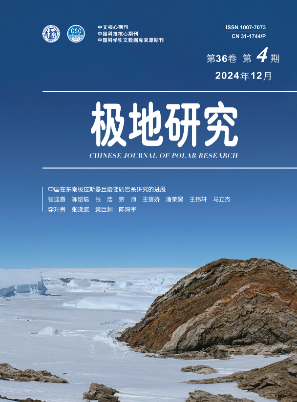
    The contributions of China to understanding the metamorphic rock series in the Larsemann Hills, East Antarctica
    CUI Yingchun, CHEN Shaocong, ZHANG Hao, ZONG Shi, WANG Xuejiao, PAN Ronghao, WANG Weixuan, MA Lijie, LI Shenggui, ZHANG Xiaobo, HUANG Julan, CHEN Hongyu
    2024, 36 (4):  505-517.  DOI: 10.13679/j.jdyj.20240067
    Abstract ( 230 )   PDF (536KB) ( 266 )  
    The Larsemann Hills are located on the Ingrid Christensen Coast of Princess Elizabeth Land, East Antarctica, have the topographer with the high in the south and low in the north. Influenced by various internal and external geological forces, including geological structure, glaciers, temperature, and polar winds, the region shows a diverse array of landforms. The predominant rock type is metamorphic rocks that have experienced the complex deformation and metamorphism from the amphibolite to granulite facies. In 1989, China constructed the year-round Antarctic research station, the Zhongshan Station, on the Mirror Peninsula, Larsemann Hills. The station then became the home for Chinese scientists undertaking earth science research in East Antarctica. The research of Chinese scientists on the metamorphic sequence, metamorphic age, protolith composition, metamorphic conditions and tectonic environment in this region over the past 35 years is summarized. The findings of Chinese scientists have greatly promoted the cognition of the evolution of the Pan-African orogenic belt. In the future, the priority should be paid more attention on the nature of regional multi-stage metamorphic events, the characteristics of mafic-ultramafic granulites, and the attributes of orogenic belts.
    References | Related Articles | Metrics
    A review of core drilling technology for subglacial bedrock in polar regions
    LI Yazhou, YANG Gansheng, ZHANG Kai, LI Bing, WANG Zufan, HUANG Ruozhou
    2024, 36 (4):  518-543.  DOI: 10.13679/j.jdyj.20230005
    Abstract ( 924 )   PDF (17986KB) ( 556 )  
    Core drilling technology for subglacial bedrock is an important means to study glaciology, palaeoclimatology and geology in polar regions. Cable-suspended electromechanical drills and rotary core drill rigs have been successfully used in subglacial bedrock coring drilling; however, use of cable-suspended electromechanical drills involves the technical challenges of drilling in hard rock and inefficient discharge of cuttings from the borehole, and for the rotary core drill rigs there are the difficulties with drilling-fluid leakage in firn and hydraulic fracturing in ice. In addition, the existing rotary core drill rigs are heavy and have a simple function. Coring drilling of subglacial bedrock in polar regions involves additional technical challenges, such as difficulty in drilling warm and debris-rich ice, borehole melting caused by heat produced in bedrock drilling, insufficient capacity of low-density drilling fluid to carry cuttings, and existing meltwater at the ice-rock interface. In this paper, based on the literature research on subglacial bedrock core drilling technologies in recent decades, the application conditions and the advantages and disadvantages of various drilling methods are systematically reviewed, and a technical optimization scheme is proposed to provide technical guidance for the implementation of subglacial bedrock core drilling projects. In the future, it will be necessary to further improve the existing subglacial bedrock core drilling technology that makes use of cable-suspended electromechanical drills and rotary core drill rigs, and to develop coiled tubing core drilling technology and the rapid air ice drilling technology. In general, there are still many disadvantages in the current technologies of subglacial bedrock core drilling. In the future, it is necessary to further develop the subglacial bedrock core drilling technology that will need to be further developed to promote the development of polar science.
    References | Related Articles | Metrics
    Prediction of NmF2 in the polar ionosphere under disturbance conditions
    XU Sheng, NIU Yuejuan, LI Peihao
    2024, 36 (4):  544-555.  DOI: 10.13679/j.jdyj.20240049
    Abstract ( 200 )   PDF (1597KB) ( 138 )  
    A new prediction model of the ionospheric F2 layer peak electron density (NmF2) during geomagnetic disturbances for 1 hour is developed, using long-term ionospheric observation data from Zhongshan Station in Antarctica and Tromsø Station in Arctic. The machine learning model named PLPR is based on the time series prediction model Prophet, Long Short-Term Memory(LSTM) and polynomial regression. The predictions produced by PLPR can better reflect the daily variations of NmF2 at both stations than can those from other models, and the prediction accuracy at Zhongshan Station is better than that at Tromsø Station. Compared with the international reference ionosphere IRI-2016 model, as well as the single time series prediction model Prophet and LSTM, the PLPR model demonstrates superior performance.
    References | Related Articles | Metrics
    Distributions, fluxes and influencing factors of dissolved CH4 in the Kongsfjorden and the Bayelva river in Spitsbergen, Arctic#br#
    ZHANG Ziqiang, DU Guanxiang, YIN Hang, ZHU Zhuoyi, ZHANG Ruifeng, JIN Jie, ZHANG Guosen, ZHANG Guiling
    2024, 36 (4):  555-568.  DOI: 10.13679/j.jdyj.20230062
    Abstract ( 213 )   PDF (9151KB) ( 121 )  
    Methane (CH4) is an important greenhouse gas in the atmosphere, and the melting of permafrost caused by rapid warming in the Arctic has become a global hotspot for CH4 emissions. The distributions and fluxes of CH4 were investigated in the Kongsfjorden and the Bayelva River of the Ny-Ålesund of the Spitsbergen, during the Arctic Yellow River Station expeditions in August 2013 and August 2015. Dissolved CH4 concentrations in the surface water of the Bayelva River were 3.9~21.5 nmol·L–1 (average (12.6±6.4) nmol·L–1) and 3.9~21.1 nmol·L–1 (average 7.0±6.9 nmol·L–1) in August 2013 and August 2015, respectively, showing a general trend of increase downward. Dissolved CH4 concentrations in the Qingchuan and Bayelva River varied greatly in time and space, and were mainly influenced by basin area and the interaction of glacial meltwater input with sediment and atmosphere. Dissolved CH4 in the surface water of the Kongsfjorden was 6.3~37.3 nmol·L–1(average (13.1±8.2) nmol·L–1) and 4.3~22.2 nmol·L–1 (average (12.0±5.4) nmol·L–1) in August 2013 and August 2015, respectively, with higher values in the head and the mouth of the fjord and lower values in the middle of the fjord. Dissolved CH4 in the water column of Kongsfjorden was 5.7~37.3 nmol·L–1 (average (15.1±8.5) nmol·L–1) in August 2013. High CH4 concentrations were observed at the water depths of 100~250 m, mainly influenced by the release from the sediments and the transport of methane from the shelf water into the fjord. The distributions of methane in the fjord of the Spitsbergen were influenced by glacial meltwater inputs, mixing of water masses and seafloor sediments. Because of the oversaturation of dissolved CH4, Kongsfjorden and the Bayelva River were sources of atmospheric CH4. The air-sea CH4 fluxes of the surface waters of the Kongsfjorden were 0.4~12.4 nmol·L–1 (average (3.5±3.4) µmol·(m2·d)–1) and 2.0~4.6 µmol·(m2·d)–1 (average (3.2±0.9) µmol·(m2·d)–1) in August 2013 and August 2015, respectively.
    References | Related Articles | Metrics
    Diversity of culturable bacteria in soils, penguin ornithogenic soils and intertidal sediments of the Fildes Peninsula region, Antarctic#br#
    HAO Puyu, ZHANG Yihe, HAN Wei, ZENG Yinxin
    2024, 36 (4):  568-580.  DOI: 10.13679/j.jdyj.20230060
    Abstract ( 170 )   PDF (3386KB) ( 161 )  
    The Fildes Peninsula region is rich in diverse microorganisms, which play important ecological roles in local biogenic element cycling and energy flow, and are potential and novel resources for microorganisms. In this study, bacteria from soils, penguin ornithogenic soils and intertidal sediments collected in the Antarctic Fildes Peninsula region were isolated using traditional cultivation techniques, and then classified based on 16S rRNA gene sequencing. A total of 408 bacterial strains were isolated, falling into four bacterial phyla and 51 genera; of these, eight bacterial strains were potential novel species. Differences in the composition of the dominant bacterial groups were observed among soils, penguin ornithogenic soils and intertidal sediments. Actinobacteria dominated in soils, whereas Bacteroidetes was predominant in intertidal sediments. Compared with Luria-Bertani (LB) and Yeast extract-Peptone-Glycerol (YPG) media, higher diversity was observed in cultivated bacteria isolated from terrestrial samples based on the oligotrophic Reasoner’s 2A (R2A) medium. The results of this study improve our understanding of bacterial diversity in the Antarctic and provide more materials for scientific research.
    References | Related Articles | Metrics
    The nutritional composition of six groups of Antarctic krill (Euphausia superba) in the Amundsen Sea#br#
    LI Lizhen, HUANG Hongliang, YANG Jialiang, LI lingzhi, JI Qun, HAN Xulei, SONG Wei
    2024, 36 (4):  580-590.  DOI: 10.13679/j.jdyj.20240035
    Abstract ( 272 )   PDF (1093KB) ( 218 )  
    Antarctic krill (Euphausia superba) is a well-recognized source of high-quality protein, which has high utilization value in the pharmaceutical chemical industry and as food and aquaculture feed. However, few studies involving comparative analysis of nutrients in different groups of Antarctic krill have been reported. To understand the nutritional composition of Antarctic krill, the levels of general nutrients, amino acids, fatty acids and mineral elements in six different groups of Antarctic krill from the Amundsen Sea were determined by biochemical analysis. There were significant differences in water, ash, crude protein and carbohydrate contents among some Antarctic krill groups, and there were significant differences in crude fat content among the six groups (P<0.05). In addition, in all six groups of Antarctic krill, cystine was not detected among eighteen common amino acids. The total amino acid content and essential amino acid content were the highest in the A11-03 group. The amino acid score and chemical score of essential amino acids in the six groups were both less than 1. The number of fatty acids detected in the A11-03, RA4-06, RA1-02, RA1-00, RA2-02 and RA3-03 groups was 24, 21, 20, 20, 18 and 17, respectively. The content of eicosapentaenoic acid and docosahexaenoic acid was the highest in the RA4-06 group. The six groups were rich in mineral elements, and the contents of major elements and trace elements were significantly different among different groups (P<0.05). In conclusion, the six Antarctic krill groups contained high levels of protein and high unsaturated fatty acids. The nutritional value of the RA4-06 and A11-03 groups was significantly different from that of the other four groups, and the RA2-02, RA1-02, RA3-03 and RA1-00 groups exhibited similar nutritional value.
    References | Related Articles | Metrics
    Analysis of the surface mass balance over the Greenland ice sheet based on regional climate model RACMO2.3
    HUAI Baojuan, DING Minghu, ZHANG Qinglin, SUN Weijun, ZHANG Wuying, CHE Jiahang, KANG Limin
    2024, 36 (4):  591-607.  DOI: 10.13679/j.jdyj.20230019
    Abstract ( 385 )   PDF (18943KB) ( 110 )  
    The Greenland ice sheet (GrIS) change consists of discharge and surface mass balance (SMB), and SMB is the net of mass income and expenditure at the ice sheet surface, dominating recent GrIS mass loss. In this study, we analyzed the detailed change of SMB and its components over the GrIS from 1958 to 2022, using monthly SMB data (1 km) from regional climate model RACMO2.3 p2 developed by the Royal Netherlands Meteorological Institute. The results show that (1) the multi-year average SMB integrated by the GrIS is 366.8 Gt·a–1, with obvious regional SMB differences. The central part of the edge of the west GrIS is the main strong ablation area (SMB<-1600 mm w.e.·a–1). The high precipitation characteristics of the southeast GrIS lead to high mass accumulation in the accumulation area, especially in the edge of the ice sheet with SMB over 3200 mm w.e.·a–1; (2) Seasonally, the summer SMB is dominated by negative balance at the ice sheet scale, and precipitation accumulation in winter shows a decreasing pattern from coastal to inland and from south to north; The main melt season starts in May and peaks in July (SMB=-123.8 Gt); (3) The interannual variations of net SMB over the GrIS was large during 1958 to 2022. The precipitation dominated the SMB changes before the 1990s. There was a significant negative trend (-48.7 Gt·(10 a)–2, p<0.05) post-1990, caused by the increase of runoff; (4) Spatially, there is a generally negative trend in SMB in the ice sheet melt zone during the study period (<-80 mm w.e.·(10 a)–2, p<0.05), due to increased surface melt and reduced refreezing. The SMB change in the southeast GrIS was forced by precipitation change. The SMB over the GrIS is significantly influenced by large-scale circulation anomalies, radiation, albedo, and ocean. Under the background of future warming, the negative trend of SMB on the GrIS will be more significant, which will induce sea level rise and should be paid more attention to. 
    References | Related Articles | Metrics
    Quantitative analysis and comprehensive evaluation of multi-source Arctic sea ice thickness data products
    LI Tongtong, WANG Yangjun, WU Hongqian, LIU Kefeng, CHEN Xi, LI Ming, LI Hongchen
    2024, 36 (4):  607-624.  DOI: 10.13679/j.jdyj.20230038
    Abstract ( 253 )   PDF (8487KB) ( 152 )  
    The study of Arctic sea ice thickness is of significant importance for understanding global climate change and exploring Arctic shipping routes. While satellite remote sensing and numerical simulation techniques have been widely employed in sea ice thickness studies, there are significant spatiotemporal discrepancies among various sea ice thickness data products, unlike the research on sea ice concentration. Therefore, this paper proposes a comprehensive quality assessment framework for sea ice thickness data products to objectively and quantitatively evaluate their accuracy and applicability. The framework extracts digital statistical features, local spatial distributions, and temporal variation pattern of different sea ice thickness products from 2010 to 2020, constructing nine evaluation indicators. Through comparative analysis with observed data, multidimensional quantitative evaluation of sea ice thickness products is achieved. The results indicate that: (1) CryoSat-2 and SMOS (CS2SMOS) products excel in five indicators, including statistical feature correlation, spatial structure similarity, interannual variation deviation, monthly change correlation, and monthly change deviation; (2) PIOMAS product best reflects the temporal characteristics of sea ice thickness during the winter half-year and exhibits optimal interannual variation correlation; (3) CPOM product performs best in three indicators, including feature statistical deviation, spatial distribution correlation, and spatial distribution deviation. The research findings can be used for the fusion of sea ice thickness data products, enabling the objective and reliable weighting of different sea ice thickness data products in different spatiotemporal contexts, thereby enhancing the objectivity and reliability of sea ice thickness data product fusion.
    References | Related Articles | Metrics
    Morphological characteristics and influencing factors of iceberg furrows on the western Amundsen Sea continental shelf margin
    ZHAO Ning, GAO Jinyao, MA Pengyun, HAN Xibin, SUN Xi, YANG Fanlin, GE Qian, DONG Chao, LU Xiaoming, YANG Chunguo
    2024, 36 (4):  623-639.  DOI: 10.13679/j.jdyj.20230003
    Abstract ( 203 )   PDF (24913KB) ( 107 )  
    Iceberg furrow is a typical iceberg erosion landform, and its morphological characteristics and influencing factors are related to iceberg morphology, keel depth and drift direction, which is helpful to understand the history and dynamics of ice shelf edge cracking. In this paper, a large number of iceberg furrows were discovered by interpreting the high-precision multi-beam water depth topography of the western Amundsen Sea shelf in Antarctica. The shape and distribution characteristics of iceberg furrows and corrugation ridge were analyzed by using the V-index model. The strike and length of iceberg furrows and the ridge height and ridge spacing of the corrugation ridge in the ridge were calculated, and the influencing factors were discussed. The width-depth ratio of iceberg furrows, the size of V-index and the morphological characteristics of the cross section can well indicate the size and shape of the iceberg keel that formed the furrows, indicating that the main strike of all iceberg furrows in the study area is NEE—SWW, and the main strike of the intact upper furrows is NE, which is mainly related to the coastal current flowing to the outer edge of the shelf. Part of the longer furrow strike is NW, which is mainly related to westward coastal current, easterly downwind or Antarctic continental slope current. The average V-index of iceberg furrow was 0.132 and the median was 0.121, and the average width-depth ratio was 32.33 and the median was 27.37. The smaller width-to-depth ratio and V-index indicate that the formation of iceberg furrows is mainly associated with smaller icebergs with deeper, sharper keels. The corrugation ridges are distributed in the interior or edge of furrows, the ridge height ranges from 0.1 to 5.7 m, the average ridge height is 2.0 m, and the ridge spacing is 10 to 288 m. The analysis shows that the formation is mainly caused by the accumulation of sediments on the back edge of icebergs under the vertical action of tides.
    References | Related Articles | Metrics
    Kinematic model of the Ross Sea Basin in Antarctic and its tectonic significance
    CAI Xiaoxian, GAO Jinyao, JIANG Jie, FAN Xinzhi, LI Na, GUO Yidong
    2024, 36 (4):  640-651.  DOI: 10.13679/j.jdyj.20230012
    Abstract ( 150 )   PDF (19329KB) ( 53 )  
    The extension history of the Ross Sea has played an important role in the tectonic evolution of the West Antarctic Rift System (WARS), however, most of the current studies have focused on the extension history of a certain period, while the extension process has not been systematically studied. We constructed a movement model for the Ross Sea Basin since its formation based on GPlates software, established the relationship between the extension process of each basin in the Ross Sea and the mantle low-velocity zone (mLVZ) in different periods, and then analyzed the influence of the plate boundary forces and the mantle magmatic activity on the WARS rifting process. During the diffuse rifting of WARS (~100–53 Ma), the Eastern Basin and Central Trough of the Ross Sea passed above the mLVZ, implying that diffuse rifting is influenced by both tectonic stretching and mantle heat. During the focused rifting of WARS (~43–11 Ma), the Victoria Land Basin and the Terror Rift were developed in the western side of the mLVZ, implying that the focused rifting was mainly influenced by tectonic stretching not by mantle heat.
    References | Related Articles | Metrics
    The characteristics of the low atmospheric wind field over the “Xuelong 2” navigation area during the 13th CHINARE
    CHEN Le, YU Zhibin, LI Mengpei, ZHANG Jie, WANG Shuoren, SANG Jinghe
    2024, 36 (4):  653-666.  DOI: 10.13679/j.jdyj.20240006
    Abstract ( 227 )   PDF (17922KB) ( 126 )  
    The Arctic has become one of the most sensitive regions to global climate change due to its amplification effect. The low-altitude wind field characteristics of the region are of great significance for the research of atmospheric evolution processes in the Arctic and even in the Northern Hemisphere, as well as to the global weather and climate. In order to finely detect the structure and changes of the wind field in the low atmosphere of the Arctic region, a set of Coherent Doppler Wind Lidar was depoyed on board the polar research icebreaker Xuelong 2 based during the 13th Chinese National Arctic Research Expedition. With the obtained low-altitude wind field data, the characteristics of the average wind field and the wind field structure of typical weather events in the cruising area are explored. The main results are as follows. (1) The average wind field over the navigation area of the Xuelong 2 is related to the monsoon. The wind direction was dominated by southerly winds in summer, with a maximum wind speed of 13 m·s–1, and the wind direction was variable in autumn. (2) The maximum wind speed in the navigation area in mid-September was dominated by northwest winds, with the maximum wind speed exceeding 25 m·s–1. The rest of the time, the wind speed in the north cold zone was approximately 8 m·s–1. (3) With the wind barbs and vertical airflow information, some typical wind field characteristics were also observed over the navigation area, including stable weak wind and stable strong wind fields, wind fields with direction and wind speed transitions, and strong convective wind fields. Atmospheric circulation changes can be inferred from typical wind fields and provide data support for weather forecasting on the future routes.
    References | Related Articles | Metrics
    The evolution of the structure and operation of the Committee for Environmental Protection
    Wan-Lu WANG
    2024, 36 (4):  667-679.  DOI: 10.13679/j.jdyj.20240022
    Abstract ( 210 )   PDF (388KB) ( 333 )  
    Currently, the initial discussions on Antarctic governance decision-making are undertaken by different organizations and institutions within the Antarctic Treaty System (ATS). As an important component of the ATS, the Committee for Environmental Protection (CEP) is a permanent body established under Article 11 of the Protocol on Environmental Protection to the Antarctic Treaty without independent decision-making powers. Since its establishment in 1998, CEP has undergone significant changes in its organizational structure and operations. The early CEP consisted of annual meetings and informal intersessional groups. With the increasing importance of environmental protection and climate change issues, two formal subsidiary groups have been set up, one to review the management plans of Antarctic Specially Protected Areas/Antarctic Specially Managed Areas and the other to implement the Climate Change Response Work Program. On these two issues, a hierarchical recommendation structure of “Formal Subsidiary Group–CEP–Antaractic Treaty Consulative Meeting” has been formed. Based on this change, China should pay attention to the latest CEP issues, and to the work during the intersessional period. In particular, cultivating professionals at all levels should be cultivated, so that they have the opportunity to deeply participate in the various CEP discussions, thus comprehensively improving the pertinence and effectiveness of China’s Antarctic institutional discursive power.
    References | Related Articles | Metrics
    A study of Arctic security cooperation between the United States and the Nordic countries#br#
    Du xiaojie
    2024, 36 (4):  680-693.  DOI: 10.13679/j.jdyj.20230025
    Abstract ( 241 )   PDF (367KB) ( 226 )  
    Against the backdrop of the Russia-Ukraine conflict and the intensification of great power rivalries,the successive accession of Finland and Sweden to the North Atlantic Treaty Organization (NATO) has radically changed the security landscape in Europe and the Arctic region The Arctic security cooperation between the United States and the Nordic countries has become increasingly close. Looking back at the history of Arctic security cooperation between the US and the Nordic countries, the security cooperation between the two sides in the Arctic region has shown characteristics such as multi-grade cooperation led by the US, multi-field cooperation with military cooperation as the focus, and the construction of a multi-dimensional and compounded cooperation mechanism based on bilateral cooperation. In general, the US Arctic security cooperation with the Nordic countries is mainly affected by the interactions between the US, the five Nordic countries, and the relevant third-party subjects such as Russia; the degree of fit between the US and the Nordic countries’ Arctic policy issues, the effectiveness of the Arctic governance mechanism; and other factors. At present, common identity and threat perceptions have laid the foundation for Arctic security cooperation between the US and the Nordic countries, and the security cooperation between the US and the Nordic countries in the Arctic region will increase in the future with the“NATO flag”already planted all over the Nordic countries. However, there are also differences between the US and the Nordic countries in terms of pursuit of power, issue selection and strategic means in the Arctic region, and the Arctic security cooperation between the two sides is still uncertain.
    References | Related Articles | Metrics
    Oil and gas resource investment assessment and analysis of influencing factors in Arctic countries
    YANG Nan, LI Kezhen, ZHANG Kaixun, WANG Dapeng
    2024, 36 (4):  694-704.  DOI: 10.13679/j.jdyj.20230083
    Abstract ( 236 )   PDF (421KB) ( 304 )  
    The Arctic is a strategic reserve for oil and gas resources and has always been a focus of attention for countries and energy companies regarding investments in Arctic oil and gas. However, existing research lacks environmental assessments specific to Arctic oil and gas investments. This study establishes an evaluation system for investment in the environmental aspects of Arctic oil and gas resources. Using the AHP-Entropy method and first-hand data on Arctic oil and gas resources, an analysis of investment evaluation in the Arctic oil and gas resource environment was conducted. The results indicate that: (1) Russia is the best partner for China’s Arctic oil and gas investments, with absolute advantages in natural resource environment, infrastructure, and service environment; (2) Norway has a good political and social reputation, making it a reliable partner in technology acquisition and carbon reduction in the field of oil and gas exploration and development; and (3) the United States and Canada are currently not conducive to investment, and it is suggested that ties should be established through non-government academic exchanges to break the ice in the field of Arctic oil and gas cooperation.
    References | Related Articles | Metrics
    Development status, challenges and coping strategies of marine communication in the Arctic Passage
    LIN Bin, WANG Haocheng, WANG Shuoren
    2024, 36 (4):  704-713.  DOI: 10.13679/j.jdyj.20230001
    Abstract ( 391 )   PDF (2943KB) ( 365 )  
    To assess the problems of marine communication in the Arctic Passage and provide a precis of coping strategies, this paper summarizes and analyzes the relevant information and literature on the development status and challenges of Arctic Passage marine communication. Currently, the main methods of marine communication in the Arctic Passage are shore-based wireless communication and satellite communication; however, the deployment of both is not yet perfect and the service is limited. Marine communication in the Arctic Passage faces many challenges from insufficient shore-based wireless communication service coverage, imperfect navigation information security systems, limited satellite elevation angles, atmospheric attenuation of signal energy and increased difficulty of communication due to harsh climate environment. This paper argues that strengthening the construction of the Arctic communication capacity by constructing coastal radio stations, expanding the coverage of Arctic satellite communication services, and improving the integrated service system of Arctic navigation security can be potential solutions to the issues of marine communication in the Arctic Passage.
    References | Related Articles | Metrics
    Analysis of the hatch cover lifting method for shipboard materials at Zhongshan Station in Antarctica
    YAO Gang, LIANG Gaosheng, LIU Shaojia, YAO Pingbo, DONG Yanlei
    2024, 36 (4):  714-719.  DOI: 10.13679/j.jdyj.20240036
    Abstract ( 201 )   PDF (2485KB) ( 473 )  
    The unloading of expedition materials at Zhongshan Station in Antarctica is the key work for all Chinese Antarctic expeditions. Materials are generally transported over the ice, however, during China's 40th Antarctic Expedition, unloading of materials could not be carried out by ice transport because the sea ice was too broken up. The large hatch cover lifting method refers to a transport method using helicopters to lift cargo directly from the hatch cover of the Xuelong to Zhongshan Station. This method was applied at a large scale during this expedition, accumulating technical experience and relevant data for subsequent applications.
    References | Related Articles | Metrics