Loading...

Archive

    30 June 2024, Volume 36 Issue 2 Previous Issue    Next Issue

    For Selected: Toggle Thumbnails
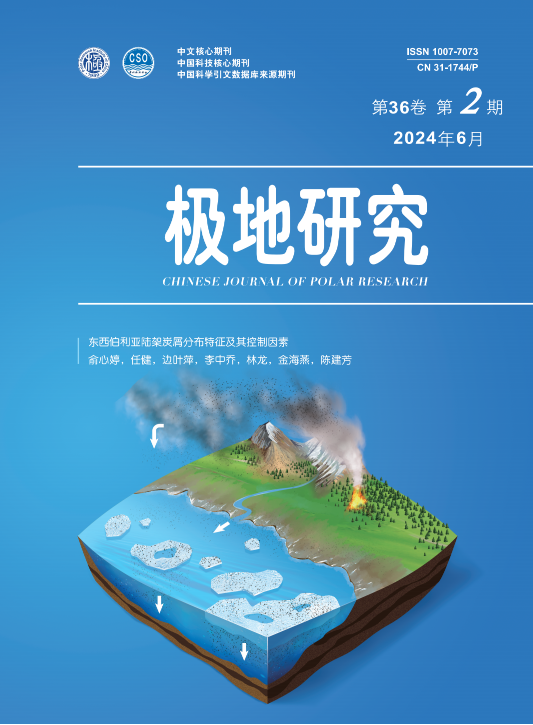
    Charcoal distribution in surface sediments of the East Siberian Shelf and its controlling factors
    YU Xinting, REN Jian, BIAN Yeping, LI Zhongqiao, LIN Long, JIN Haiyan
    2024, 36 (2):  113-127.  DOI: 10.13679/j.jdyj.20230008
    Abstract ( 370 )   PDF (17506KB) ( 227 )  
    Charcoal is a direct indicator of fire events. In the context of global warming and frequent circumpolar Arctic wildfires, the generation, migration and burial of charcoal are key elements contributing to the understanding of the environmental effects of Arctic climate change and the source–sink trajectory of terrestrial carbon. However, there are few studies on charcoal in the Arctic Ocean. The East Siberian Shelf (ESS) is the largest continental shelf in the world, receiving and sequestering large amounts of terrestrial carbon. It is also one of the Arctic regions where the melting of sea ice, coastal erosion, and wildfires are the most pronounced, making it a favorable area to study the charcoal record in the Arctic. On the basis of the surface sediment samples obtained from the first Sino-Russian joint Arctic research expedition in 2016, the distribution, concentration, relative abundance, transport process, and the controlling factors of charcoal on the ESS of different sizes were studied. The results show that the total concentration of charcoal in the ESS surface sediments lies between 4.4×10⁴ and 4.1×10⁶ grains·g–1, with an average of 9.3×10⁵ grains·g–1. Coarse charcoal particles were found near shore and fine particles were found offshore. As a result of long-distance transport by hydrodynamics and wind, charcoal particles in the study area are dominated by ultrafine grains (83% on average). River input, coastal erosion, atmospheric transport, sea ice and current processes may jointly influence the cross-shelf pathway of charcoal.
    References | Related Articles | Metrics
    Distribution characteristics and potential environmental risks of heavy metals in seabed surface sediments of Prydz Bay, Antarctica
    ZHANG Hao, CUI Yingchun, SHAO Hebin, LI Shenggui, ZONG Shi
    2024, 36 (2):  128-139.  DOI: 10.13679/j.jdyj.20230043
    Abstract ( 370 )   PDF (998KB) ( 366 )  
    To understand the characteristics of major heavy metal pollutants in the surface sediments of Prydz Bay, Antarctica, this study analyzed the content of six heavy metals–copper (Cu), lead (Pb), zinc (Zn), cobalt (Co), nickel (Ni) and chromium (Cr)–in samples of surface sediments obtained during the 29th Chinese National Antarctic Research Expedition. The potential environmental risks of heavy metals in the surface sediments of Prydz Bay were evaluated by using the potential ecological risk index and geological accumulation index. The results show that Zn had the highest average concentration, followed by Cr, Cu, Ni, Pb, and Co in descending order of concentration. Concentrations were low near shore and high far shore; spatial distributions of the different heavy metals were homologous, indicating similar source supply and deposition processes. Potential ecological risk index showed that ecological risk was low at all survey stations; the geological accumulation index of heavy metal elements was less than zero, indicating clean sediments. The average value of comprehensive potential ecological risk was 7.45. Correlation analysis showed that all heavy metals except Pb were positively correlated with titanium (Ti) and with average sediment particle size, and were  negatively correlated with the sorting coefficient.
    References | Related Articles | Metrics
    Spatial and temporal variability of three-dimensional structure of the Arctic cloud: A seasonal variation
    FENG Shijie, HUANG Fei, LIU Yifan, ZHANG Yifan, ZHOU Teng
    2024, 36 (2):  140-157.  DOI: 10.13679/j.jdyj.20230016
    Abstract ( 464 )   PDF (4054KB) ( 490 )  
    This paper investigates the climatic state and seasonal variation characteristics of the three-dimensional structure of Arctic cloud fraction based on the three-dimensional spatial data of CALIPSO clouds averaged over the multi-year climate months from 2007 to 2020. The results show that the Arctic cloud fraction is mainly distributed in the atmospheric boundary layer and troposphere, and the cloud fraction decreases from the boundary layer to the upper layer; the horizontal spatial distribution mainly shows significant sea-land differences, and the maximum cloud fraction occurs in the Arctic Atlantic sector; the vertical structure shows a positive pressure structure with the in-phase change above and below the troposphere and a first-order oblique pressure mode structure with inverse phase change between the lower atmospheric boundary layer and the middle and upper troposphere. The cloud fraction over the ocean is larger than that over the Arctic land, while the opposite is true in the upper and middle troposphere. The Arctic cloud amount mainly shows the seasonal variation of single-peak type, with the least amount of cloud fraction in February and March and the most amount of cloud fraction in September. The seasonal variation of Arctic clouds is mainly reflected in the two main spatial and temporal modes of cloud fraction in the boundary layer of the low atmosphere, the first mode mainly reflects the inverse phase variation of Arctic melt (May–October) and freezing (November–April), with a variance contribution of 59.35%. The second mode mainly reflects the inverse phase variation of land-sea differences in the Arctic in late autumn (October–November) and early summer (June–July), with a variance contribution of 19.22%.
    References | Related Articles | Metrics
    Characteristics of the Southern Ocean temperature and specific humidity inversions from the Atmospheric Infrared Sounder (AIRS) on the Aqua satellite
    XU Yan, CHANG Liang, LI Lili
    2024, 36 (2):  157-168.  DOI: 10.13679/j.jdyj.20220438
    Abstract ( 347 )   PDF (25272KB) ( 223 )  
    The temperature inversion (TI) and specific humidity inversion (SHI) are common over the Southern Ocean, and their distribution and variation have important effects on the exchange of matter and flux between ocean, ice and air. In this study, the TI and SHI characteristics of the Southern Ocean were extracted from data obtained by the Atmospheric Infrared Sounder (AIRS) on the Aqua satellite, and the characteristics of their temporal and spatial distributions and variations were studied. In addition, using the sounding results of the Integrated Global Radiosonde Archive 2 as reference values, the effects of cloud in the AIRS TI and SHI estimates were analyzed. The results show that the characteristics of the TI from AIRS data are less affected by clouds, and AIRS can accurately estimate the characteristics of TI under cloudy conditions. The frequency and strength of the TI and SHI over the Southern Ocean from 2004 to 2020 were studied using the latest version of AIRS data (V7). It is found that TI and SHI are higher and stronger in autumn and winter than in spring and summer, and are more frequent and stronger in the Ronne Ice Shelf, Ross Ice Shelf, and the sea area near the Antarctic Peninsula than in other regions.
    References | Related Articles | Metrics
    A sea ice motion retrieval method using floe shape features based on Sentinel-1 imagery in the Arctic Nares Strait
    YANG Fan, LIU Tingting, LEI Ruibo
    2024, 36 (2):  169-182.  DOI: 10.13679/j.jdyj.20220444
    Abstract ( 413 )   PDF (17481KB) ( 246 )  
    The Nares Strait is one of the most important passages for sea ice outflow from the Arctic Ocean. It plays a crucial role in the formation of deep water in the Baffin Bay and Labrador Sea and in the Arctic sea ice mass balance. Because of the narrow entrance and low sea ice concentration, it is difficult to retrieve valid sea ice motion information from satellite imagery using existing sea ice motion tracking algorithms. Therefore, there are limited sea ice motion data for this region. In this study, a sea ice motion retrieval algorithm based on ice floe shape features is proposed. It consists of three main steps: image segmentation, ice floe extraction and ice floe matching. Sea ice motion data in the Nares Strait from 20 February to 27 February 2019 were retrieved using the proposed algorithm, and were compared with manually produced validation data to evaluate the accuracy of the ice floe extraction and matching steps. Results show that the mean error of the ice floe shape features ranges from 4.3% to 8.48%, the overall accuracy of the ice floe motion vectors retrieved by the algorithm is 84%, and the root mean square error of the matched centroid and velocity is 0.171 km and 6.313 cm·s1, respectively. Compared with existing feature tracking algorithms, including SIFT, ORB, and AKAZE, sea ice motion coverage and accuracy derived from the proposed algorithm are higher by 27.7% and 39%, respectively. The proposed algorithm is not only an effective way to retrieve sea ice motion data for the Nares Strait, but provides some reference for sea ice motion retrieval in other regions (e.g., marginal ice zone).
    References | Related Articles | Metrics
    Comparison and evaluation of Arctic sea ice thickness based on Chinese CMIP6 model
    WANG Ziqi, WANG Xiaochun, JIN Meibing, YU Xiaoyong, ZHAO Liqing
    2024, 36 (2):  183-198.  DOI: 10.13679/j.jdyj.20220439
    Abstract ( 550 )   PDF (17060KB) ( 258 )  
    In this research, output from eight Chinese Earth climate system models from the International Coupled Model Intercomparison Project Phase 6 (CMIP6) were selected. The spatial distribution and long-term trend of the multi-year mean Arctic sea ice thickness between 1980 to 2014 from the models were evaluated by comparing them with the sea ice thickness data assimilation product from the Pan-Arctic Ice-Ocean and Assimilating System (PIOMAS). The capability of each model was quantified using the Taylor Score. The results show that there are differences between output from all models and PIOMAS data in both March and September, and the deviations are mainly located in the north of Greenland, the Barents Sea, and around the Bering Strait. Models underestimate March and September ice thickness of the Arctic central region in, and generally overestimated the thickness of the Arctic sea ice margin region in March. In terms of spatial distribution of ice thickness, the difference between PIOMAS data and FIO-ESM-2-0 output is the smallest among the eight models and the difference between PIOMAS and FGOALS-f3-L is the second smallest. The long-term trend of sea ice thickness is negative, with sea ice thickness decreasing faster, in September than in March. In terms of the spatial distribution of the long-term sea ice thickness trend, the difference between PIOMAS data and model output is the smallest for NESM3 among the eight models. The radiation components from the eight CMIP6 models were compared with three reanalysis products and one satellite data set for the region north of 82°N to examine the factors underlying the model bias in sea ice thickness. There are large differences among the radiation components of the reanalysis products and the model output, with clear anomalies in the radiation of two models. The upward shortwave radiation of FGOALS-f3-L in March and that of CIESM in September are remarkably low, which may be the reason for the bias in the sea ice thickness simulation of these two models.
    References | Related Articles | Metrics
    Analysis of Greenland Ice Sheet mass changes using satellite gravity and altimetry data
    LI Guangyu, ZHAO Xu
    2024, 36 (2):  199-210.  DOI: 10.13679/j.jdyj.20230026
    Abstract ( 614 )   PDF (7019KB) ( 229 )  
    Global sea levels would rise by 7 m, if the Greenland Ice Sheet (GrIS) were to melt completely. Therefore, an accurate estimate of the mass change over the GrIS is of great importance for the understanding of the reaction of the GrIS to global climate change. Using nearly 20 years of monthly gravity field data provided by the Gravity Recovery and Climate Experiment (GRACE) and GRACE-Follow On (GRACE-FO) mission, as well as satellite altimetry data from European Remote Sensing (ERS-2), Envisat, and CryoSat-2, this study comparatively analyzes the characteristics of GrIS mass change between April 2002 and December 2020. Results demonstrate that: (1) the spatial distributions of mass change trends estimated by GRACE/GRACE-FO mascon solutions and satellite altimetry data are relatively consistent; both indicate severe mass loss in the low-elevation regions around the GrIS margin and a mass accumulation in the inner plateau. (2) The mass loss of the GrIS contributed to a global mean sea level change of 0.73 ± 0.01 mm∙a−1 between 2002 and 2020. (3) The southwest and northwest regions of the GrIS contributed to 43.69% of the total sea level change, making them the primary contributors to sea level rise. (4) We compared basin-scale mass change estimates from the satellite altimetry with those from mascon solutions and found that the Goddard Space Flight Center (GSFC) mascon solutions is the closest.
    References | Related Articles | Metrics
    Interannual variation of summer sensible and latent heat fluxes in the Ross Sea from 1993 to 2022
    YAO Jie, HE Hailun, SUN Qun, YU Lejiang, ZHANG Yijie, YU Lusha, LI Xueqi
    2024, 36 (2):  211-220.  DOI: 10.13679/j.jdyj.20220432
    Abstract ( 394 )   PDF (4722KB) ( 383 )  
    Atmospheric surface sensible and latent heat fluxes are important environmental variables in the coupled ocean–ice–atmosphere system. This study quantifies the interannual variations of summer sensible and latent heat fluxes in the Ross Sea of the Southern Ocean and presents a preliminary discussion of the possible factors influencing the interannual variations of sensible and latent heat fluxes. Based on the European Centre for Medium-Range Weather Forecasts (ECMWF) Fifth-generation Reanalysis (ERA5) data, the interannual variations of sensible and latent heat fluxes during the summer months of 1993–2022 in the Ross Sea were studied. The absolute values of the January climatological sensible and latent heat fluxes on the shelf are higher than those in the deep basin. Results from the empirical orthogonal function analysis of sensible heat and latent heat flux anomalies show that the first three modes explain more than 75% of the total variance. For the first modes, there are roughly consistent regional spatial patterns as well as considerable interannual variations in the time coefficients; dominant periods are approximately 2.9 and 4.4 years. Spatial averages of sensible heat and latent heat fluxes on the shelf indicate high correlation between the interannual variations of sensible and latent heat fluxes. Finally, sensible heat flux shows relatively high correlation with wind speed and air–sea temperature difference, latent heat flux shows relatively high correlation with wind speed and air–sea specific humidity difference, while these correlations show clear spatial variations. Study results provide a reference for the study of ocean–ice–atmosphere interactions in the Ross Sea.
    References | Related Articles | Metrics
    Identification and phylogenetic analysis of soil enzyme-producing bacteria from Fildes Peninsula, Antarctica
    YUAN Jialin, DANG Guangzhen, WANG Long, LIU Jie
    2024, 36 (2):  221-232.  DOI: 10.13679/j.jdyj.20230002
    Abstract ( 335 )   PDF (843KB) ( 303 )  
    This study focuses on the soil bacteria isolated from 10 different micro-ecological environments on Fildes Peninsula. The extracellular enzyme producing capacity and species identification of the isolated bacteria were analyzed by special enzyme-producing plate culture and 16S rDNA sequencing methods, respectively. The results showed that most of the strains producing amylase, protease, cellulase, ester hydrolase and alginase were mainly distributed in the areas close to the coast and rich in animals ormosses, but relatively few species of extracellular enzyme producing bacteria were found in the inland of peninsula. Among 125 extracellular enzyme-producing bacteria, 87 strains were found to have high extracellular enzyme-producing capacity, and many of them could produce more than two kinds of enzymes. In addition, none of the isolated bacteria produced gelatinase, carrageenase, or chitinase. Results of the phylogenetic analysis showed that the 64 representative strains with high extracellular enzyme producing capacity were in 7 classes, 17 genera. Among them, the strains with high amylase producing capacity were in 3 classes, 5 genera. Strains with high protease capacity were in 7 classes, 14 genera. Strains with high cellulase capacity were in 1 class,1 genus, Strains with high ester hydrolase capacity were in 4 classes, 7 genera, Strains with high a esculase capacity were in 7 classes, 13 genera, Strains with high DNA hydrolase capacity were in 5 classes, 11 genera. Strains with high catalase capacity were in 2 classes, 2 genera. Strains with high oxidase capacity were in 1 class, 1 genus. In addition, we also found that 6 strains could be the potential novel species in Pedobacter, Chryseobacterium, Flavobacterium, and Kaistella. This study provides valuable reference and strain resources for the research and development of cryogenic microorganisms and cryogenic enzymes.
    References | Related Articles | Metrics
    Critical behavioral factors of ship officers navigating in polar waters based on cloud model
    YANG Zhaojun, XI Yongtao, HU Shenping, FU Shanshan
    2024, 36 (2):  232-239.  DOI: 10.13679/j.jdyj.20220429
    Abstract ( 356 )   PDF (3121KB) ( 391 )  
    To systematically investigate the influence of human factors on navigation safety in polar waters, the Human Factor Analysis and Classification System-Polar Navigation Analysis (HFACS-PNA) model was proposed. The model combines the Human Factors Analysis and Classification System (HFACS) and Performance Influence Factor (PIF) with the actual characteristics of navigation scenarios in polar waters and uses survey data and the forward cloud generator algorithm based on a cloud model. Among 49 subfactors in the model, the critical factors that lead to ship officers making errors when navigating in polar waters were identified. The results show that the critical behavioral factors are based on 28 subfactors including unsafe supervision, preconditions for unsafe acts, and aspects of unsafe acts. The identified critical influence factors can help researchers and safety managers take adequate measures to improve safety and prevent the occurrence of human error during navigation in polar waters.
    References | Related Articles | Metrics
    Discrete element method analyses of the polar high-density sintered snow under the unconfined compression tests
    LI Tao, HUO Haifeng, HU Biao, JIA Wentao, CHEN Qingwei
    2024, 36 (2):  240-253.  DOI: 10.13679/j.jdyj.20220436
    Abstract ( 380 )   PDF (2436KB) ( 363 )  
    Artificial snow compaction and sintering, which is the process of turning fresh snow into general snow, is a basic method for the construction of polar snow runway. Snow compaction densifies the snow pavement and snow sintering increases the bond size between snow particles and hence improves the strength of the snow pavement. In order to investigate the mechanism of the bond breakage evolution and stress bearing mechanism of the dense sintered snow under the unconfined compression test (UC), the three-dimensional discrete element method (DEM) was employed. A bond contact model for the sintered snow was introduced and the contact parameters were calibrated through published experiments results, firstly. Then, the discrete element model was established and the UCs were carried out; The DEM results are verified and the conclusions are as follows: (1) Intensive bond breakage occurs at the shear band of the dense sintered snow sample under UC, with bond fracture predominantly attributed to shearing under tension. (2) The crushing of snow particles affects the shear strength of the snow pavement, and the effect of high stress on the internal friction angle needs to be carefully considered. The study provides scientific support to predict the mechanical characteristics of compacted sintered snow under complex stress paths through simple in-situ tests in polar regions.
    References | Related Articles | Metrics
    Development and improvement of Chilean Antarctic legislation—Focusing on Law No. 21255
    WU Ningbo, YANG Ziyang
    2024, 36 (2):  254-265.  DOI: 10.13679/j.jdyj.20230035
    Abstract ( 377 )   PDF (408KB) ( 467 )  
    Antarctica has always been one of Chile’s core national interests because of its relative geographic proximity and territorial claims to Antarctica which prompts Chile to play an important role in Antarctic affairs. Chile has always regarded Antarctic legislation as a significant means to safeguard its Antarctic rights and interests and respond to the changes of situation in different historical periods. It has established a developed and improved legal system which take “Antarctic territory” management as the basic framework and based on the adjustment of Antarctic policy objectives and development of the Antarctic Treaty System. The Law No. 21255 which has taken effect in 2021, is the typical representative of keeping pace with the times that has certain enlightenment significance for China’s Antarctic legislation.
    References | Related Articles | Metrics
    Review of the spatial-temporal features of phytoplankton biomass and biological productivity in Antarctic polynyas and influencing factors
    JIANG Ning, ZHANG Zhaoru
    2024, 36 (2):  266-285.  DOI: 10. 13679/j.jdyj.20220440
    Abstract ( 475 )   PDF (22372KB) ( 304 )  
    Polynyas play an important role in climate change and ecosystem environment. This paper reviews the spatial-temporal features and variations of phytoplankton biomass and productivity in four Antarctic polynyas, the Ross Sea, Amundsen Sea, Pine Island, and Mertz polynyas as well as the effects of physical parameters and climate modes on chlorophyll-a and the onset and duration of phytoplankton blooms in the polynyas. The conclusion of the paper are as follows: (1) the Ross Sea polynya is the area with the highest biological productivity in Antarctic marginal seas, accounting for 28% of the total productivity of the Southern Ocean; the Amundsen Sea and Pine Island polynyas have the highest productivity per unit area among 37 Antarctic polynyas ecosystems; there are obvious interannual variations of phytoplankton biomass in the Mertz polynya. (2) Sea ice concentration, wind speed, cloud cover, and other physical parameters are closely related to phytoplankton biomass, with obvious seasonal and regional characteristics. Sea ice concentration affects the photosynthetically available radiation reaching the sea surface by changing the amount of open water in polynyas; wind speed affects the vertical mixing intensity and changes the vertical distributions of nutrients and phytoplankton; the influence of cloud cover on polynya ecosystems is the result of the balance between the intensities of visible light and ultraviolet radiation. In some polynyas, there is a significant correlation between the interannual variation of phytoplankton biomass and the climate modes (such as the Southern Annular Mode and Semiannual Oscillation). regulating the climate variability at high latitudes in the southern hemisphere. In the future, long-term satellite remote sensing observations, in-situ observations and numerical simulations can be combined to explore the physical-ecological coupling mechanism between the climate modes and phytoplankton biomass, and advance the understanding of the variations and mechanisms of ecosystem productivity in polynyas with the goal of improving understanding of the biogeochemical cycling in key polar regions and its role in modulating the climate system.
    References | Related Articles | Metrics
    Analysis of distribution and exploitation of oil and gas resources in the Arctic region
    SUN Di, ZHANG Houhe, HAO Jing, LI Chunrong, LIU Shixiang, JIANG Dexin, LI Yican
    2024, 36 (2):  286-303.  DOI: 10.13679/j.jdyj.20240001
    Abstract ( 723 )   PDF (1369KB) ( 975 )  
    The Arctic region has significant potential for oil and gas resources, which is important in optimizing energy import structure and dispersing oil import risk in China. Using the latest data from Standard and Poor’s Global and the United States Geological Survey, this study analyzed the history of oil and gas exploration and development in major countries around the Arctic and the temporal and spatial distribution of oil and gas resources in the region. The results show that: (1) Arctic oil and gas exploration and development is mainly conducted by Russia, the USA, Canada, Norway, and Denmark, and can be divided into four stages: early investigations (before 1963), discovery on land and early development (1964–1976), sea-land common developments on land and offshore and rapid production (1977–1992), exploration downturn and development based on high oil position (1993–present). (2) In the Arctic, 519 oil and gas fields have been discovered, with cumulative proved and probable (2P) recoverable reserves, cumulative production, and undiscovered potential resources of 47400 million tons, 16200 million tons, and 115900 million tons of oil equivalent, respectively; the composition and geographical distribution of oil and gas are uneven, and resources are present in different categories of countries. Combining these results with the current situations in major Arctic countries and future prospects for the resource exploitation, positive cooperation with Russia in natural gas exploration and development, domestically and internationally, is recommended. China would actively expand international cooperation in exploiting liquefied natural gas  and developing infrastructure for the Arctic shipping route on the basis of consolidating the pipeline natural gas construction process.
    References | Related Articles | Metrics
    Analysis and evaluation of current Chinese polar expedition icebreaker logistic support capability
    XIA Yinyue, CHEN Qingman, JIANG Jingjian
    2024, 36 (2):  304-315.  DOI: 10.13679/j.jdyj.20220435
    Abstract ( 446 )   PDF (4941KB) ( 658 )  
    China’s polar exploration activities have developed increasingly over the past 40 years. However, deficiencies remain in the comprehensive security of polar icebreaker capacity, especially relative to the needs of China and those of the developed countries. For example, currently, China’s polar icebreakers can only offer limited operating time in ice-covered regions and increased capability is required to support comprehensive scientific research such as the study of interactions in the ice-sea-air-biology system. This paper reports the results of a comprehensive analysis of the support capabilities of R/V Xuelong and R/V Xuelong 2, which are the Chinese polar ice breakers that are in active service. The modes of operation with respect to logistics support and scientific investigation activities are reviewed and are compared with the characteristics of the mainstream polar research vessels from other countries. This paper probes into the differences, challenges, and shortcomings in support capability, management mode, and operation mechanism, and puts forward ideas and suggestions to further improve China’s comprehensive polar research capability.
    References | Related Articles | Metrics