Loading...

Archive

    30 December 2023, Volume 35 Issue 4 Previous Issue    Next Issue

    For Selected: Toggle Thumbnails
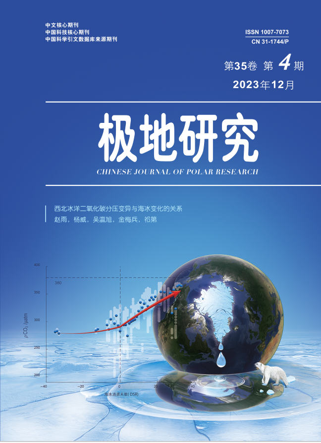
    Relationship between pCOvariation and sea ice change in the western Arctic Ocean
    Zhao Yu, Yang Wei, Wu Yingxu, Jin Meibing, Qi Di
    2023, 35 (4):  499-507.  DOI: 10.13679/j.jdyj.20220421
    Abstract ( 861 )   PDF (1795KB) ( 917 )  
    Sea ice retreat in the Arctic Ocean has caused an increase in open water area, which has consequently contributed to the absorption of more carbon dioxide (CO2) by surface seawater, and an increase in the partial pressure of CO2 (pCO2). However, there is a lack of research on the dramatic changes in pCO2 during sea ice retreat and its interaction with sea ice. Based on the 3rd Chinese National Arctic Research Expedition data in 2008, this study found that the distribution of summer sea surface pCO2 in the western Arctic Ocean was characterized by low values on the shelf and high values in the ocean basin. The study area overall was a sink for atmospheric CO2, with air-sea CO2 fluxes of 13.8 mmol·m–2·d–1 in the shelf area and 3.7 mmol·m–2·d–1 in the basin. This study used a mass balance model to investigate the response of sea surface pCO2 in the Canadian Basin during the whole period of sea ice melting process. The results showed that: (1) during the melting process, pCO2 slowly increased by air-sea CO2 exchange; (2) after the sea ice had completely melted and with prolonged exposure of the sea surface to the air, the combined effects of air-sea CO2 exchange and warming resulted in a rapid increase in pCO2, and the rate of increase was higher than that in the melting stage.
    References | Related Articles | Metrics
    Surface meltwater on the Greenland ice sheet mapped from PlanetScope small satellite imagery
    Zhu Yuxin, Zhang Wensong, Yang Kang,
    2023, 35 (4):  508-516.  DOI: 10.13679/j.jdyj.20220419
    Abstract ( 751 )   PDF (4467KB) ( 963 )  
    Surface melt of the Greenland ice sheet and its impact on rising sea levels have become hot topics in international research. Each summer, surface meltwater forms on the Greenland ice sheet, forming supraglacial lakes, supraglacial rivers, and water-filled crevasses. There is a large area of surface meltwater, which exhibits complex structure, and changes rapidly over time. Regional climate models do not accurately simulate the distribution of surface meltwater, and medium resolution satellite images may not reflect spatial and temporal changes in surface meltwater. CubeSats, such as PlanetScope, allow dynamic monitoring of surface meltwater by providing near-daily satellite observation at 3 m spatial resolution. In this study, we extracted surface meltwater in a typical internally drained catchment in the southwest Greenland ice sheet using PlanetScope images. We then constructed a formula to estimate meltwater depth from the PlanetScope images and compared meltwater volume estimated by satellite images and meltwater runoff simulated by the MAR v3.11 model. The results showed that the open water fraction (OWF) of surface meltwater in the catchment first rose then decreased during July and August 2019, peaking on 12 July (8.7%). The surface meltwater depth in the catchment ranged from 0.2 to 1.5 m, and the supraglacial lakes were the deepest (0.9 m±0.2 m), followed by the mainstem of supraglacial rivers (0.6 m±0.1 m), and the tributaries of supraglacial rivers (0.5 m±0.1 m). The OWF, meltwater volume and daily runoff simulated by MAR were positively correlated, indicating that meltwater runoff directly supplies supraglacial lakes and rivers. The surface meltwater storage capacity is limited (<1%), and the catchment is efficiently transporting meltwater into the ice sheet.
    References | Related Articles | Metrics
    Detection and evaluation of the Weddell Polynya based on sea ice  concentration products
    Kuang Huiyan, Hua Jiancong, Ye Yufang, Cheng Xiao, Hui Fengming, Chen Zhuoqi
    2023, 35 (4):  517-532.  DOI: 10.13679/j.jdyj.20220426
    Abstract ( 751 )   PDF (7098KB) ( 439 )  
    Sea ice concentration (SIC) products have been widely used in the detection of polynyas. Eight typical SIC products retrieved from passive microwave remote sensing data (NSIDC-BT-25km, NSIDC-NT2-25km, NSIDC-NT2-12.5km, NSIDC-NTBT-25km, EUMETSAT-BTBR-25km, EUMETSAT-BTBR-10km, UH-ASI- 12.5km and UB-ASI-6.25km) were adopted to detect the Weddell Polynya openings in 2016 and 2017 using five SIC thresholds (15%, 40%, 50%, 60% and 70%) separately. Morphological post-processing operations were then applied to optimize the results. On this basis, the effects of different SIC thresholds, retrieval algorithms, and spatial resolutions of the SIC products on the area/extent of polynya were compared, and the influence of morphological post-processing operations on the results was further explored. The results showed that NSIDC-NTBT-25km demonstrated the highest sensitivity to thresholds, while NASA Team 2 (NT2) algorithm-retrieved SIC products showed the lowest sensitivity and the area/extent of polynya detected from which were generally smaller than those detected by BT (Bootstrap) and ASI (ARTIST Sea Ice) products. High spatial resolution SIC products were more likely to derive polynya with earlier opening times and longer duration, and the area/extent of polynya detected from these were also larger as well. Additionally, spatial resolution exerted the least impact on NT2-retrieved products and had the greatest impact on ASI-retrieved products. Morphological post-processing operations showed some influence on the detected results, yet the effect was less than that of the retrieval algorithms and spatial resolutions.
    References | Related Articles | Metrics
    Optimized efficiency evaluation method for Antarctic research station network based on local features
    Cheng Kunfeng, Liu Haiyan, Pang Xiaoping
    2023, 35 (4):  533-541.  DOI: 10.13679/j.jdyj.20220208
    Abstract ( 656 )   PDF (780KB) ( 773 )  
    To evaluate the Antarctic research station network efficiency under different site layouts, an optimized network efficiency evaluation method was proposed based on local properties. The relative importance of points and edges was evaluated, based on Analytic Hierarchy Process (AHP) and Technique for Order Preference by Similarity to an Ideal Solution (TOPSIS), to represent the local properties of the network. The relative importance was substituted in the modified network efficiency model to obtain the operational efficiency of the network. This method was used to analyze the operational efficiency of China’s, the United States’ and Australia’s Antarctic research station networks. This method is suitable for efficiency evaluations of different networks, which can provide a reference for site selection or overall layout adjustments of new Antarctic research stations in the future.
    References | Related Articles | Metrics
    Coupling between iceberg rafted debris events and bottom current activities in the northwestern Weddell Sea during the last glacial period
    Yan Bin, Xie Jingqian, Wu Li, Huang Bo
    2023, 35 (4):  542-555.  DOI: 10.13679/j.jdyj.20220437
    Abstract ( 689 )   PDF (1137KB) ( 859 )  
    During the late Quaternary, climate changes drove the advance and retreat of ice shelves in and around the Antarctic. Icebergs carried iceberg rafted debris (IRD) by calving, floating, and melting into the ocean. The large amount of melt water altered the structure of ocean water profiles and activities, which also affected the deposition of IRD. The association between IRD events and bottom current activities is not yet fully understood. Here, we present a sediment record retrieved from the northwestern Weddell Sea. Obvious peaks of four-IRD events were observed parallel with four bottom water enhancement events, based on a precise comparison of grain size data and End Member Model Analysis. These synchronous events revealed a coupling mechanism between the ocean and glacial systems. Two strong washing events supported the existence of two discontinuities of sedimentation, which explained the age difference between the paleomagnetism reverse and the AMS14C data. As the very low export productivity was similar to that at a glacial level, we deduced that most of this core was deposited in the last glacial period. The millennial temperature increases in the Antarctic triggered ice shelf retreats and led to obvious IRD events and bottom current activities.
    References | Related Articles | Metrics
    Numerical simulation of Arctic sea fog and radio wave attenuation
    Zhang Yusheng, Guo Xiangming, Hao Xiaojing, Zhao Qiang, Zhang Rui
    2023, 35 (4):  556-565.  DOI: 10.13679/j.jdyj.20220417
    Abstract ( 764 )   PDF (5325KB) ( 1050 )  
    The Arctic region has a harsh climate and an important strategic location. The shortest straight distance between countries in North America, northern Europe and northern Asia is the path through the Arctic. Meteorological, navigation, communication, radar and other support are needed during the Arctic cruises. Arctic sea fog, which reduces the visibility at sea, can cause ships to lose their routes resulting in serious accidents such as grounding and collision. Sea fog can also cause radiowave propagation phenomena, such as atmospheric ducting over the horizon and serious attenuation of millimeter waves. Using the global reanalysis data, based on the mesoscale atmospheric numerical model suitable for the Arctic region, this paper successfully simulated the Arctic fog and its evolution and development encountered in the 4th Chinese National Arctic Research Expedition in the Arctic Ocean by improving the Noah land surface process scheme, the long wave radiation scheme (RRTMG scheme) and other settings. Based on Mie scattering theory and Rayleigh scattering theory, the unit distance attenuation values for millimeter wave and far infrared band were evaluated. For the two representative frequencies in the millimeter wave band (100 GHz and 30 GHz at the high and low ends of the frequency band), the attenuation value increased gradually with the water content of sea fog at the 30 GHz, but the change was gentle. At 100 GHz, the attenuation value increased rapidly with the water content of sea fog. For the two representative wavelengths of the infrared band (0.1 cm and 50 µm at the high and low ends of the band), the attenuation value increased gradually with the water content of sea fog at the wavelength of 0.1 cm, but the change was slow. At the wavelength of 50 µm, the attenuation value increased rapidly to hundreds of dB·km–1 with the water content of sea fog. The attenuation values of the two wavelengths differed greatly. For the same water content fog area, the far infrared attenuation value per kilometer was far greater than that of the millimeter wave. The attenuation values of high and low end of the millimeter wave band and at the highest end of the infrared wave band (0.1 cm) were generally less than a few tens of dB·km–1, while the attenuation value at 50 µm, the lowest end of the infrared wave band, was several hundred dB·km–1, which was much larger than other bands. The Polar WRF model can simulate and obtain more accurate characteristics of Arctic sea fog. The model can also be used to evaluate the spatial and temporal effects of Arctic sea fog on electromagnetic wave propagation attenuation and radio information system characteristics.
    References | Related Articles | Metrics
    Numerical study of the effect of ice roughness on the aerodynamic characteristics of symmetric and asymmetric airfoils
    He Zhihui, Zhang Yongheng, Zhang Xuyao, Zhang Li, Li Ze, Yang Wentao
    2023, 35 (4):  566-579.  DOI: 10.13679/j.jdyj.20230021
    Abstract ( 695 )   PDF (12731KB) ( 501 )  
    When wind turbines operate in cold regions, the blade is prone to ice formation, which changes the blade’s shape and affects its aerodynamic performance. To assess the influence of icing surface roughness on the aerodynamic performance of wind turbine blade airfoils, the aerodynamic characteristics of two types of airfoils, symmetric (NACA-0012) and asymmetric (NACA-23012), were compared under the same icing conditions and icing roughness parameters using a computational fluid dynamics method. The results showed that when rime ice was generated at the leading edge of both NACA0012 and NACA23012 airfoils, the ice roughness had a significant effect on the aerodynamic performance of both icing airfoils. When horn ice was generated at the leading edge of both airfoils, the effect of ice roughness on the aerodynamic performance of the NACA23012 icing airfoil was small, and only increased the width of the separation vortex at the trailing edge of the airfoil. There was, a greater effect of horn ice on the NACA0012 airfoil than the NACA23012 airfoil, which delayed the stall angle of attack of NACA0012 icing airfoil. In addition, when rime ice was generated at the leading edge of both NACA0012 and NACA23012 airfoils, the drag coefficient of NACA23012 with rime ice airfoil increased faster than that of NACA0012 icing airfoil.
    References | Related Articles | Metrics
    Discussion on design methods for polar compacted snow runways
    Huo Haifeng, Li Tao, Chen Qingwei, Jia Wentao, Hu Biao
    2023, 35 (4):  580-590.  DOI: 10.13679/j.jdyj.20220423
    Abstract ( 727 )   PDF (1789KB) ( 1014 )  
    As the world’s most powerful countries increase their investment in Antarctic scientific research, the construction of polar airports will play a significant role in ensuring aviation transportation. However, China’s research on the design of polar runways has rarely been reported. Here, two foreign methods of compacted snow runway design are introduced in detail, namely the double-layer elastic system method and the empirical method. The elastic method uses Burmister’s theory to calculate pavement deflection, whereas the empirical method obtains the pavement design index through measured deflection data. Taking the A320 aircraft as an example, a comparative analysis was performed of runways designed using these two methods. The advantage of the elastic method is that the same deflection standard can be used for different combinations of pavement design; the limitation is that single wheel load and the number of load actions are not considered. The empirical method considers a variety of aircraft parameters, but the deflection standard 10 mm cannot be changed. The comparison, indicated that the empirical method considers more aircraft parameters and, under the same deflection standard, the pavement design index of the empirical method was higher than that of the elastic method. Furthermore, the empirical method met strength design requirements while considering deflection. Thus, the empirical method design is deemed to be more scientific and safer than the elastic method. This study provides important reference data for the design and construction of polar compacted snow runways for China.
    References | Related Articles | Metrics
    Review and prospect of ice radar technology for polar ice and snow detection
    Xing Zhirui Lang Shinan Zhao Bo Dou Yinke Xiao Peng Li Lin Sun Bo Cui Xiangbin,
    2023, 35 (4):  591-606.  DOI: 10.13679/j.jdyj.20220431
    Abstract ( 844 )   PDF (7540KB) ( 650 )  
    Ice radar is the main technical means for detecting polar ice and snow. It provides important basic observational data for studying the geometric characteristics, internal structure, subglacial topography and environment of polar ice and snow. In the 1950s, humans first discovered that electromagnetic waves in specific frequency bands could “penetrate” the Antarctic ice sheet, and in the 1960s developed an ice radar system for the detection of polar ice sheets under ice. Over the past 60 years, with the development of computers, electronic information, and satellite positioning and navigation technology, the research on ice radar technology has achieved rapidly developed, resulting in a diversified ice radar system suitable for the different detection requirements of polar ice sheet, sea ice and snow cover. Based on a brief review of the development of early ice radar technology, this paper reviews and summarizes the main progress over the past 10 years, in China and abroad, in three aspects: deep detection of polar ice sheets, shallow detection of polar ice sheets and sea ice, and new polar ice and snow detection ice radar technology. To meet needs for future research on the observation of polar ice sheets, sea ice, and snow cover, it will be necessary to further improve the performance of ice radar systems (including detection depth, cross-track resolution, and vertical resolution), develop small, low-power ice radar systems that meet the needs of new platforms (such as drones and satellites), and develop multi-channel, multi-frequency, multi-polarization integrated ice radar technology.
    References | Related Articles | Metrics
    Research process for microplastic contamination in Antarctic biota
    Chen Zongzheng, Fang Chao, Miao Xing, Wang Rui, Bo Jun, Zheng Ronghui, Li Yuan, Lin Longshan, Zhang Jing
    2023, 35 (4):  607-618.  DOI: 10.13679/j.jdyj.20220411
    Abstract ( 696 )   PDF (388KB) ( 708 )  
    Microplastics are plastic fragments, threads, fibers, microspheres or films with a particle size of less than 5 mm and they can enter the Antarctic through human activities, atmospheric and oceanic circulation, and biological carriers. In this study, we summarize and categorize studies on plastic (especially microplastic) ingestion by Antarctic organisms pulished between 1980 and 2022. We describe the current status of microplastic ingestion by Antarctic organisms in descending order of trophic level and compare the degree of microplastic contamination in Antarctic organisms with other regions. Microplastic enrichment exists in Antarctica from low trophic levels to high trophic levels. Microplastic contamination in Antarctic organisms is at a middle-lower level globally. However, there is a paucity of research on microplastics in Antarctic organisms, and the potential long-term effects of microplastics on Antarctic organisms are unknown, so that it’s an urgent need to strengthen relevant monitoring research.
    References | Related Articles | Metrics
    Species diversity, low-temperature adaptation, and biotechnology application of Antarctic algae 
    Deng Qian , Gao Baoyan , Tang Zihan , Zhang Chengwu
    2023, 35 (4):  619-629.  DOI: 10.13679/j.jdyj.20220425
    Abstract ( 783 )   PDF (418KB) ( 1250 )  
    Algae are the main contributors to the primary productivity of the Antarctic and the basis of marine and terrestrial food webs. To cope with low temperatures, algae have formed a series of anti-stress mechanisms through long-term adaptation and evolution, which are essential to maintain the stability of the polar habitat. This paper summarizes the diversity and distribution of Antarctic algal species, reveals the adaptive strategies of algae in low-temperature environments (e.g., changes in the lipid composition of the cell membrane, production of intracellular and extracellular active substances, and evolutionary mechanisms), and summarizes the wide application of psychrophilic algae in nutrition and health, medical treatment, and the chemical and cosmetics industries. Further research is needed on Antarctic algal diversity, multiomics, the breakthrough of low-temperature algal culture technology, and the use of new low-temperature and low-temperature tolerant algal biological resources. With ongoing exploration of algal thermal adaptation strategies, algae adapted to low-temperature environments are likely to receive more attention in the future.
    References | Related Articles | Metrics
    Analysis on evolution of atmospheric sciences’ frontier in the Arctic and Antarctic studies using Web of Science database
    Wang Shuting, Li Na, Wu Xinnian
    2023, 35 (4):  630-645.  DOI: 10.13679/j.jdyj.20220442
    Abstract ( 700 )   PDF (3737KB) ( 640 )  
    Atmospheric science has become a hotspot and frontier field in polar research. Here, we review atmospheric science research in the Arctic and Antarctic published between 2000 and 2022, using the three databases of the Web of Science core collection. We analyzed trends in the number of studies, keyword emergence, highly cited results, and the co-occurrence of keywords. (1) To date, Arctic research has mainly focused on topics such as the Arctic amplification effect, polar warming and glacier melting, climate model innovation and CMIP6 model application, east Asian extreme cold events, and the occurrence mechanism of extreme abnormal climate phenomena. (2) Antarctic research has mainly focused on topics such as surface mass balance, sea ice melting and climate variability, climate model innovation and CMIP6 model application, thermohaline circulation, and future climate change prediction. (3) China’s research on the polar regions is at a stage of rapid development, and the relationship between the polar regions and climate change in China should be further explored through the application of innovative theories and models. (4) To cope with climate change and promote the implementation of carbon peaking and carbon neutrality strategies, the mechanisms of atmospheric circulation and extreme climate events, as well as carbon emission monitoring, carbon cycle research, and polar climate simulation, should be a focus for future research.
    References | Related Articles | Metrics
    An abroad research progress on the Arctic tourism
    Wang Wulin, Luo Wanlu, Wang Chengjin, Gong Jiao
    2023, 35 (4):  646-661.  DOI: 10.13679/j.jdyj.20230015
    Abstract ( 677 )   PDF (4045KB) ( 596 )  
    In recent years, foreign academic circles have produced important research in the field of Arctic tourism. Using bibliometry and a systematic literature review, we analyzed the number of publications, keywords, journals, authors and their institutions, citation frequency, and other quantitative changes in relevant foreign studies and their network relationships, and extracts from six research findings (e.g. “The study of tourism behavior pattern constitutes an important content of Arctic tourism research”). From these results, we evaluated current deficiencies in Arctic tourism research and future implications. The results show that: (1) The journals with the most publications and citations included Arctic, Polar Geography, and Annals of Tourism Research. The most popular keywords included Arctic, tourism, and climate change. The main authors included Stewart E J, Dawson J, and Grimwood B S R, and the main research institutions were the University of Ottawa, University of Oulu, and UiT The Aretic University of Norway. (2) The study of tourism behavior pattern constitutes an important content of Arctic tourism research; the positive and negative impacts of Arctic tourism coexist dialectically in the context of climate change; tourism management is an important pillar for the sustainable development of Arctic tourism; the core objective of Arctic tourism development policies and measures is to ensure sustainability; and the experience of scarcity and uniqueness is a significant and indispensable part of Arctic tourism. Arctic communities face multiple changes in economic, social, political, environmental, and cultural systems as a result of tourism activities. There are challenges in Arctic tourism research, such as demarcating the boundary of the Arctic region, how to consider the dynamic nature of the Arctic region in statistical monitoring, and ethical the requirements and sustainable development. The scale of research teams dedicated to creating and expanding knowledge on Arctic tourism is relatively small, and the relevant theoretical basis is still relatively weak.
    References | Related Articles | Metrics